Download Agreement, Release, and Acknowledgement of Risk:
You (the person requesting this file download) fully understand mountain climbing ("Activity") involves risks and dangers of serious bodily injury, including permanent disability, paralysis, and death ("Risks") and you fully accept and assume all such risks and all responsibility for losses, costs, and damages you incur as a result of your participation in this Activity.
You acknowledge that information in the file you have chosen to download may not be accurate and may contain errors. You agree to assume all risks when using this information and agree to release and discharge 14ers.com, 14ers Inc. and the author(s) of such information (collectively, the "Released Parties").
You hereby discharge the Released Parties from all damages, actions, claims and liabilities of any nature, specifically including, but not limited to, damages, actions, claims and liabilities arising from or related to the negligence of the Released Parties. You further agree to indemnify, hold harmless and defend 14ers.com, 14ers Inc. and each of the other Released Parties from and against any loss, damage, liability and expense, including costs and attorney fees, incurred by 14ers.com, 14ers Inc. or any of the other Released Parties as a result of you using information provided on the 14ers.com or 14ers Inc. websites.
You have read this agreement, fully understand its terms and intend it to be a complete and unconditional release of all liability to the greatest extent allowed by law and agree that if any portion of this agreement is held to be invalid the balance, notwithstanding, shall continue in full force and effect.
By clicking "OK" you agree to these terms. If you DO NOT agree, click "Cancel"...
Mount Evans B 8.2 Miles - 2,600' - 6 hr 0 min Saturday 14-January-2023
No one on this trip seemed to be able to tell me why I couldn't see the Sawtooth or Mt. Bierstadt from the summit...
Location
Elevation (ft)
Distance (mi)
Split (mi)
Time
Time (HH:MM)
Split (HH:MM)
West Mosquito Pass Winter Trailhead
11,100
0.0
0.0
07:51 14-Jan-2023
00:00
00:00
Mount Evans B Summit
13,577
4.1
4.1
11:20 14-Jan-2023
03:29
03:29
West Mosquito Pass Winter Trailhead
11,100
8.2
4.1
13:51 14-Jan-2023
06:00
02:31
Introduction Not really some long winded introduction for this Trip Report here. This happened to be a trip organized by Colorado Mountain Club's Trailblazer's group. The fearless Trip Leader for this being the one and only Davis Woodward!
There's a bit of beta out there already for this peak, but maybe less so for this particular route. There is this report from Marmot72, and there is a GPX library upload. I'm sure there's more beta if you dig but one way or another though this route is pretty straightforward.
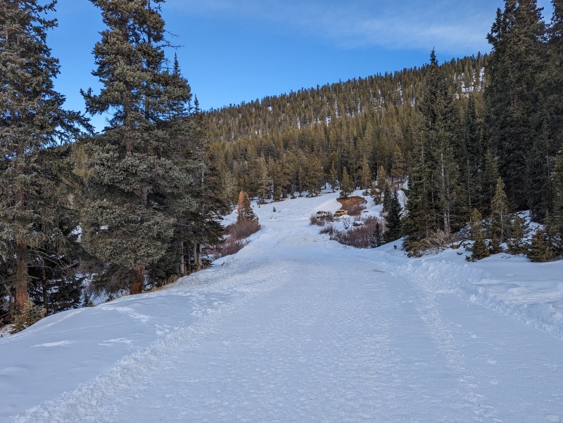
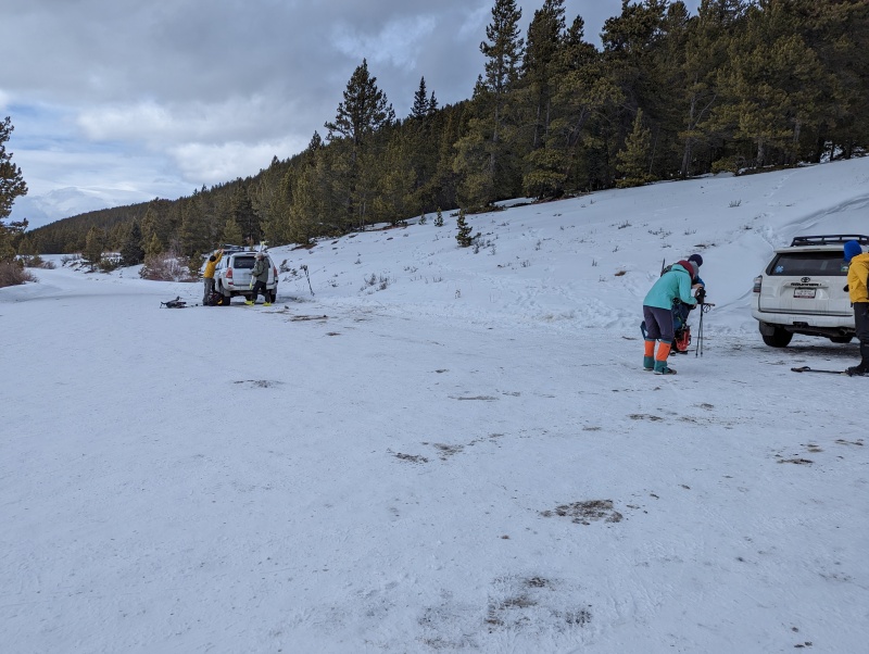
West Mosquito Pass Trailhead To take this route to summit, simply follow 7th Street East out of Leadville. It'll become Lake County Road 3, and just follow it pretty much as far as it will go, which will be the West Mosquito Pass Winter Closure if you're doing it the time of year where there's white stuff on the ground. Here plowing ends and there should be some room to park. Of course, if this were summer the road just continues as the Mosquito Pass road all the way to Alma.
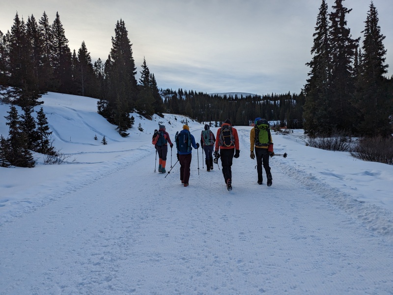
The full party ended up being myself, our leader Davis, Sydni, Sarah, Kyra, and Ryan. Some of us carpooled from the Woolly Mammoth I-70 Park and Ride and some of us camped out "at the trailhead" the night before. As one might expect, though not all of us had met each other before we certainly had some mutual "Colorado Mountain" acquaintances. After a planned arrival time of 7:30 AM we managed to start out on our route around 7:50 AM.
Just starting out and looking back at the "Winter Closure"CMC Trailblazers ready to blaze some trail!
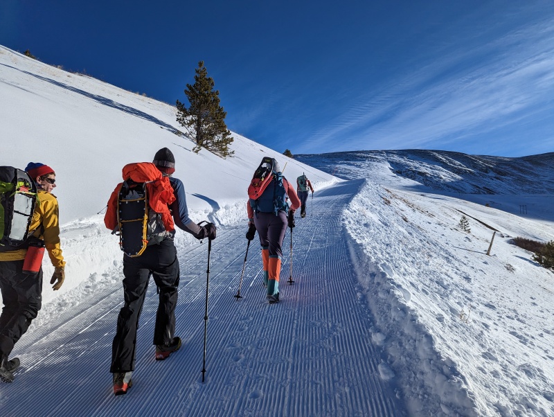
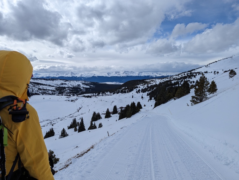
First Part of the Ascent: The Easy Bit As Davis confirmed via some research ahead of time, there happens to be a local snowmobile club in possession of a Sno-Cat that grooms much of CR3 and some of it's offshoots. And indeed CR3 beyond the "winter closure" was freshly groomed the morning we set out to Mount Evans B, making the first part of the ascent pretty darn easy. Granted they only groom to about 12,000' on the Mosquito Pass road itself, but we'll take it! I'll have to say it's not clear to me how often they get out to groom however, so take this with a grain of salt. This route follows the Mosquito Pass road more or less to the N-S ridge that connects Mount Evans B with Kuss Peak, and that grooming ends a good bit of vertical footage before that ridge.
I'll also say that this should be relatively safe route in terms of avalanche danger but just be aware that there are small, but steep, slopes in the vicinity of the route that you should nevertheless keep an eye on (particularly right before the grooming ends)
Continuing on the groomed CR3. Diamond Mine directly ahead, the N-S ridge connecting Evans B and Kuss Peak in the distance.Groomed CR3 continues. Some slopes near CR3 are steep and can hold snow.End of grooming on Mosquito Pass road around 12,000'
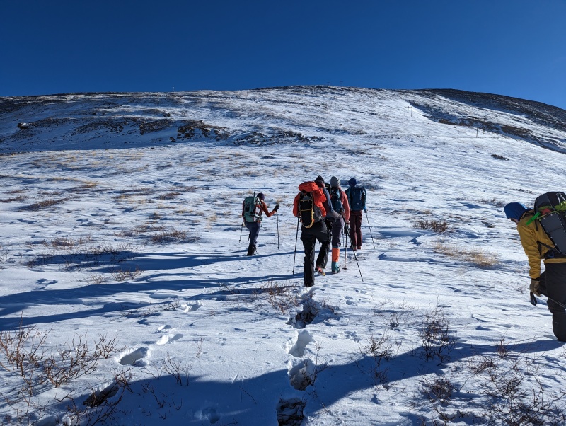
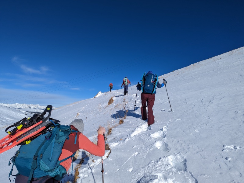
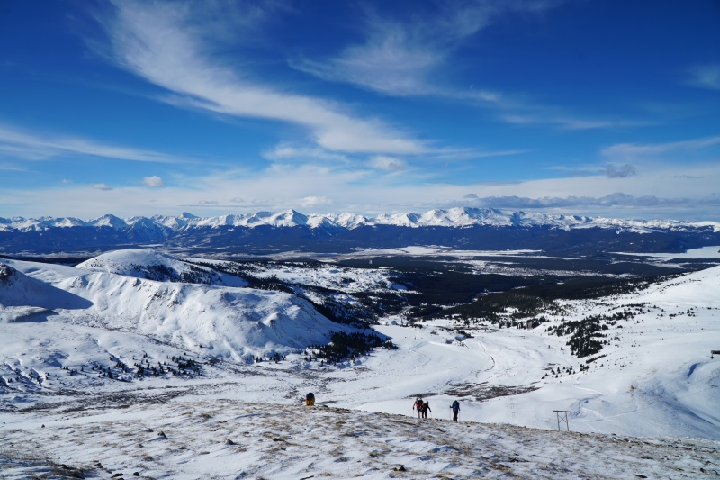
Second Part of the Ascent: The Ridge After the grooming ended there was a little bit of an increase in difficulty in terms of our route, but overall not much to write home about especially considering this was winter... Snow coverage was pretty thin. We all brought snow shoes but never put them on as the snow was firm enough not to punch through or if we did it usually wasn't deeper than calf deep. From the end of grooming the road switchbacks up to the aforementioned N-S ridge but we opted to more or less go straight up to gain the ridge in order to save some distance.
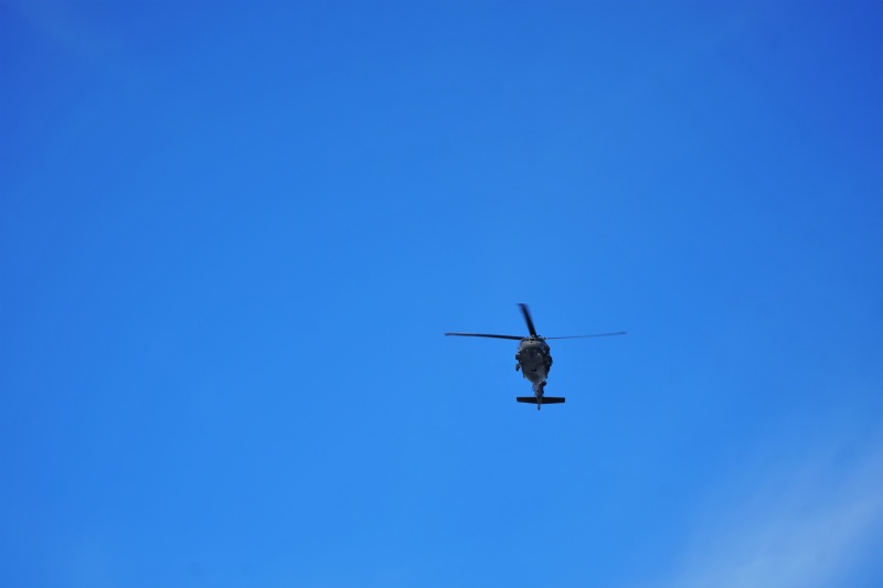
Worth noting that maybe halfway up we did happen to see a Blackhawk helicopter fly almost directly overhead. No idea what their mission was but hopefully not anything SAR related!
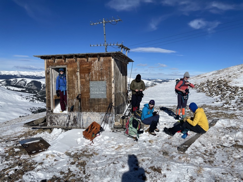
Around 13,000' we ran into an old communication shack, the first of a few we would run into on this route, and took a short break. It was here we really started to feel the wind as well. I wasn't the only one with a Kestrel weather meter on the mountain today! At this point I was reading air temp in the high teens and wind speeds in the low 30 mph range.
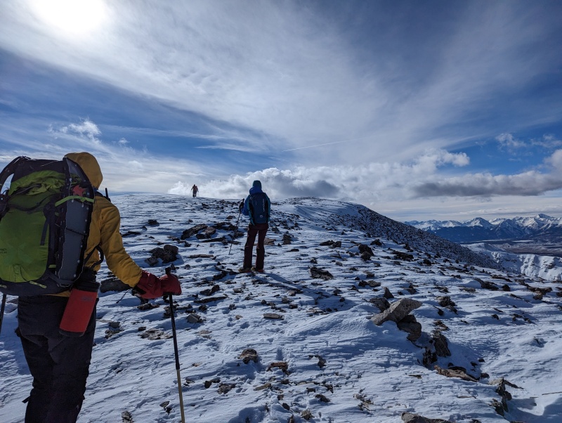
Working our way up to the ridge. Aside from a few willows here right at the start not much in the way of postholing.Continuing up the ridge.Blackhawk on approachWonder what its mission was? Photo Credit: SydniGetting close to the ridge.Looking back to Leadville. Photo Credit: SydniShort break at the first communication hut we ran across. Photo Credit: Kyra & Ryan
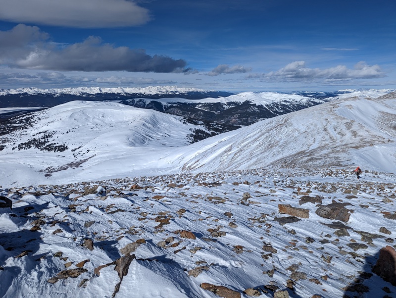
Final Push & Summit After the short break it was just a short jaunt south along the ridge to Evans B summit. Along the way we ran across more com huts, including one that had some interesting mural painted on it. After that it was a short steep push follow by a long gradual rise that seemed almost flat to summit proper.
Again snow coverage was thin, meaning that we never really needed to use the snow shoes we all happened to be carrying on our packs... Wind certainly picked up though. From the point we were approaching summit to when we were actually on summit our Kestrels measured winds sustained in the mid 30 mph range, but there was at least one 48 MPH gust that I measured as well. Resulting wind chill was in the negative single digits to the negative teens. We reached summit well before noon but didn't linger given the rather uncomfortable wind.
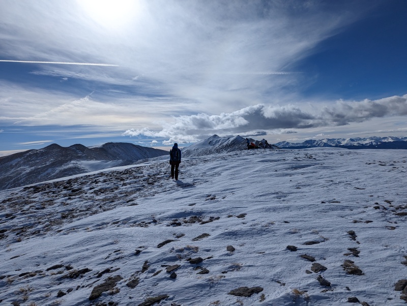
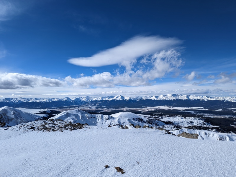
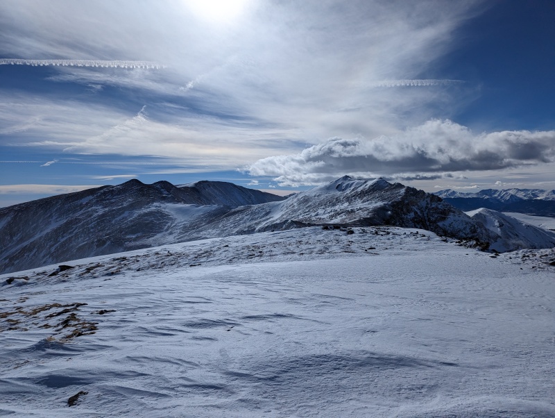
Looking at the last bit of the route from the hut we took our break at.Another view of the last bit of the route and some more communication huts.Wonder what message they were trying to leave here.One last steep bit.After that last steep bit it's something of a long flat bit until you actually get to summit proper.Approaching summit.Summit. Looking west towards Swatch w/ Elbert, Massive, Leadville and more.
Summit. Looking south towards Sherman, Gemini, and Dyer.Summit. Looking east. Pennsylvania Mountain Centered, Silverheels left, Pikes Right.Wind pushed camera sideways? Photo Credit: Sydni
The Descent and Conclusion This is an out and back route. So after opting to quickly escape the wind on summit we headed down to the lower part of the ridge and the com huts we passed. We took another decent break at the first hut we stopped at on the way up around 13,000'. Here Kyra and Ryan decided to depart the trip to go quickly bag Kuss a short distance away, though the rest of us opted to just head back down. Not too much to report for the descent from this point. Most the snow on the way down from the ridge was pretty easy to plunge step through, though there was at least one short icy stretch that was a little sketchy that we had to work on bypassing. And of course once we got back to the groomed road it was a cakewalk. We ran into at least one snowmobiler and a couple skiers on the road before we made it back to the trailhead.
Overall a good day with a good group! Also pretty easy route for winter! Especially considering the thin snow coverage and groomed road. The wind was the only thing that really reminded us it was winter but it still wasn't by any means horrendous.
Still confused why I wasn't able to place where the Sawtooth Traverse over to Bierstadt started when I was on summit though, nor why I couldn't seem to see Bierstadt at all!?
Looking North-ish at the route down.On the road again working our way down.Packing up at the trailhead where there were also some skiers.
My GPS Tracks on Google Maps (made from a .GPX file upload):
Thumbnails for uploaded photos (click to open slideshow):
Comments or Questions
Caution: The information contained in this report may not be accurate and should not be the only resource used in preparation for your climb. Failure to have the necessary experience, physical conditioning, supplies or equipment can result in injury or death. 14ers.com and the author(s) of this report provide no warranties, either express or implied, that the information provided is accurate or reliable. By using the information provided, you agree to indemnify and hold harmless 14ers.com and the report author(s) with respect to any claims and demands against them, including any attorney fees and expenses. Please read the 14ers.com Safety and Disclaimer pages for more information.
Please respect private property: 14ers.com supports the rights of private landowners to determine how and by whom their land will be used. In Colorado, it is your responsibility to determine if land is private and to obtain the appropriate permission before entering the property.


")
")
")
")
")
")
")
")
")
")
")
")
")
")
")
")
")
")
")
")
")
")
")
")
")
")

