From the trailhead, head west on the well-defined Browns Creek Trail (
1). After approximately 1.4 miles, you'll arrive at a junction. Turn right onto the Colorado Trail (
2) and follow it north for 0.3 miles. At another junction, make a sharp left turn onto the Little Browns Creek (#1430) Trail (
3). From this point, continue west and southwest until the trail descends slightly, eventually reaching Little Browns Creek near 10,200' (
4).
Continue heading west, as the trail steadily ascends alongside the creek (
5). When you reach 11,000', you have hiked 4 miles from the trailhead. Near 11,700' the terrain begins to open, and a little farther up you'll reach tree line (
7). Keep going, cross Little Browns Creek, and climb a steeper slope to reach the upper drainage (
8). With the creek now just off to your right, continue heading west (
9). The trail eventually ends at the broad saddle between Mount Antero and the 13er, Mt. White, at 12,830' (
10).
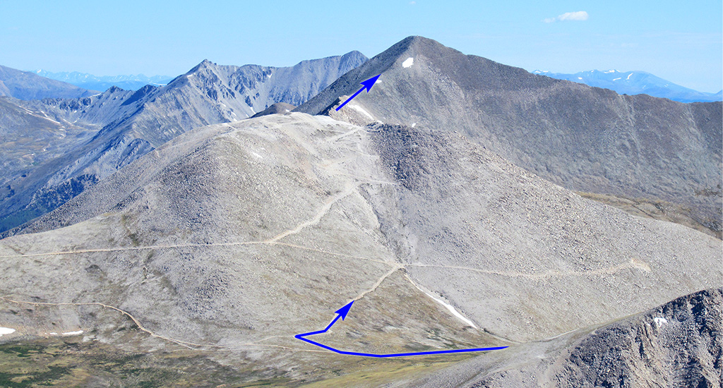
From the north slopes of Mt. White,
11 shows the road system leading to Mt. Antero's upper terrain. From the end of the trail, turn right onto a road (
12) and follow it briefly before turning right again at the next intersection (
13). After a short stretch, stay right and head northeast (
14). Follow this long stretch of road until you reach 13,100', where you'll turn left (
15). Climb another 100 feet to reach the final road junction at 13,200' (
16). Next, the road switchbacks upward, reaching approximately 13,700' (
17) on the eastern side of Point 13,800' (
18).
Pass through an ugly mining area to arrive at Antero's south ridge. Leave the road and follow trail segments along the right side of the ridge crest (
19,
20). This section features the most engaging terrain of the route. After traversing the ridge, you'll come to a small saddle at 13,850', at the base of the final ascent (
21). Aim for the summit by staying near the ridge crest (
22). Finally, gain the summit and take in the stunning views (
23).
