Download Agreement, Release, and Acknowledgement of Risk:
You (the person requesting this file download) fully understand mountain climbing ("Activity") involves risks and dangers of serious bodily injury, including permanent disability, paralysis, and death ("Risks") and you fully accept and assume all such risks and all responsibility for losses, costs, and damages you incur as a result of your participation in this Activity.
You acknowledge that information in the file you have chosen to download may not be accurate and may contain errors. You agree to assume all risks when using this information and agree to release and discharge 14ers.com, 14ers Inc. and the author(s) of such information (collectively, the "Released Parties").
You hereby discharge the Released Parties from all damages, actions, claims and liabilities of any nature, specifically including, but not limited to, damages, actions, claims and liabilities arising from or related to the negligence of the Released Parties. You further agree to indemnify, hold harmless and defend 14ers.com, 14ers Inc. and each of the other Released Parties from and against any loss, damage, liability and expense, including costs and attorney fees, incurred by 14ers.com, 14ers Inc. or any of the other Released Parties as a result of you using information provided on the 14ers.com or 14ers Inc. websites.
You have read this agreement, fully understand its terms and intend it to be a complete and unconditional release of all liability to the greatest extent allowed by law and agree that if any portion of this agreement is held to be invalid the balance, notwithstanding, shall continue in full force and effect.
By clicking "OK" you agree to these terms. If you DO NOT agree, click "Cancel"...
Heavenly Views: Cielo Vista North Peaks, 2022 Update
The Cielo Vista Ranch thirteeners comprise the vast majority of privately owned thirteeners in Colorado. Aside from Bartlett Mountain, site of the Climax molybdenum mine, Mariquita Peak and De Anza Peak B immediately to the north of Cielo Vista Ranch (hereby CVR), and Hamilton Peak in the Blanca massif, CVR owns all the remaining private thirteeners, plus of course 14er Culebra Peak. The group of thirteeners north of Culebra, the subject of this trip report, is less sought after than those south of Culebra, as the southern group contains one Centennial thirteener and two Bicentennials. I wrote these trip reports for the CVR thirteeners in the interest of providing up-to-date information on accessing these peaks, since that information isn't really collected in a single, easy-to-find place.
Please note: this information was current as of July, 2022 and may be out of date by the time you read this report. It was updated in June, 2024 to state that De Anza Peak and Mariquita Peak are NOT part of CVR property and are NOT legally accessible from CVR property.
Older editions of Gerry Roach's Colorado's Fourteeners and Colorado's Thirteeners guidebooks contain references to a $100 fee for Culebra, with a $50 add-on fee for Red. There is only a single $150 fee now for one or both peaks.
There is no hiking or climbing allowed from August through December due to hunting.
You will be let onto the ranch from the north gate at 6am and you have until 6pm to return to ranch headquarters. If you are not at the gate by 6:15am you will lose your spot and will not be refunded. If you return from your climb past 6pm you will be required to contribute $100 to the Costilla County Search and Rescue team.
In winter CVR requires a minimum of two people in a group to climb Culebra and Red. You do not have to know each other nor stay together, there just must be two people minimum on that day. Summer days always fill up so there's no problem having a minimum of two climbers.
2WD vehicles will have to be left at ranch headquarters. 4WD vehicles with clearance can drive to the upper trailhead. In winter everyone must park at ranch headquarters regardless of vehicle. Snowmobiles, ATVs, bikes, and any off-road vehicles are prohibited.
For all of the other peaks, including thirteeners:
The fee for the thirteeners is broken down into two groups: Beaubien Peak through Culebra (north to south), and Purgatoire Peak through Culebra (south to north). PER GROUP the fee is $500. See the map: https://caltopo.com/m/JUD5
No, you cannot pay $500 to run the entire ridge in one day. Yes, I asked - it is still $1,000 total for all the thirteeners, even if you're capable of running the entire ridge at once.
This fee includes whatever twelvers you can tag west of the ridgeline - everything east of the ridgeline is owned by the Bar NI Ranch and is not accessible from CVR.
This fee includes Mariquita Peak and De Anza Peak B, despite those peaks not being on CVR property.Update June, 2024: Mariquita and De Anza are not on CVR property and are not legally accessible from CVR property. Do NOT access these peaks from Forest Service land to the north, it is illegal and there are cameras. Do NOT access these peaks from CVR property to the south, it is illegal and there are cameras. You will be charged with trespassing.
This fee includes Culebra and Red with either or both groups, if you wish to add those on.
You can climb these groups on back-to-back days if you wish. It sounded like previously CVR did not allow this but that Heather and I were the first and I assume they will allow it in the future.
CVR requires a minimum of two people in a group to climb the thirteeners. You do not have to know each other nor stay together, there just must be two people minimum on that day.
For the northern group you will meet the ranch staff the night before at the Whiskey Pass gate, which is a different gate from the gate to ranch headquarters. See the map: https://caltopo.com/m/JUD5
For the southern group you will meet the ranch staff the night before at the normal ranch headquarters gate. See the map: https://caltopo.com/m/JUD5
You will be let onto the property the night before and ranch staff will escort you to one of two places:
North group at Whiskey Pass: beautiful area below the pass at treeline with a small parking area and some flat spots for tents.
South group on Purgatoire Peak's west ridge: much smaller parking area in the trees. Not much in the way of flat spots for tents.
You can continue driving down into Alamosito Creek, but that would be pointless.
You MUST have a 4WD vehicle to access these peaks. A Subaru will probably get you to Whiskey Pass, but I wouldn't take anything less than a 4Runner, Tacoma, or equivalent up to Purgatoire's west ridge.
Since you are on the property the night before your climb you can start whenever you want. Aim to finish before 6pm, of course.
Ranch staff will move your vehicles to another location on the day of your climb, if you request it.
For the north group it would be almost impossible to do an out and back and finish in time, so moving vehicles to the start of the Carneros Creek drainage is standard.
For the south group most people just do Purgatoire, "Alamosito", and Vermejo before returning to their vehicle on Purgatoire's west ridge. We asked ranch staff to move our vehicle to the Culebra 4WD trailhead and went over Red and Culebra on a one-way trip. If you've never even done Culebra and Red but are interested in the additional twelvers and thirteeners this is a smart way to do the extra peaks and save $150.
I wanted to personally thank the ranch staff, Carlos de Leon and his two sons, Enrique and Javier. They coordinated with us for two years (we had a vehicle breakdown the day before our climbs the first year and had to cancel last minute), answered tons of questions, bent the rules to allow us to climb two days in a row, drove all over the ranch for us, moved our vehicles for us both days, and were super friendly throughout it all. If you get the pleasure of talking to these fine gentlemen on climbs of your own be sure to thank them. They work their asses off for us climbers.
With all that laid out, it's time to get to...
The Climb
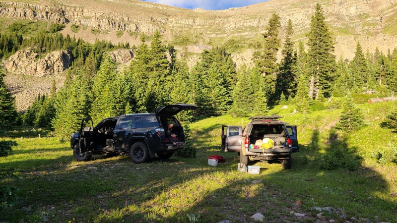
We were scheduled to arrive at the Whiskey Pass gate the night before our climb, on Friday, July 8th, at 6pm. Right on time Enrique and Javier met the three of us at the gate. We each had our own vehicles since Alex was only doing the north group, and Heather and I would be going opposite directions when we departed the ranch on Sunday, so after they checked us in I left my van in a parking area a bit up the road, out of sight of the gate. I hopped in with Heather and we followed the ranchers up the road. Heather drove her 4Runner and Alex his Tacoma, neither of which had any trouble getting up the road. My van would have been capable (it's 4x4) but some small, downed trees hanging over the road would have hit the roof. None of us took any photos of the road since it didn't seem like that big of a deal.
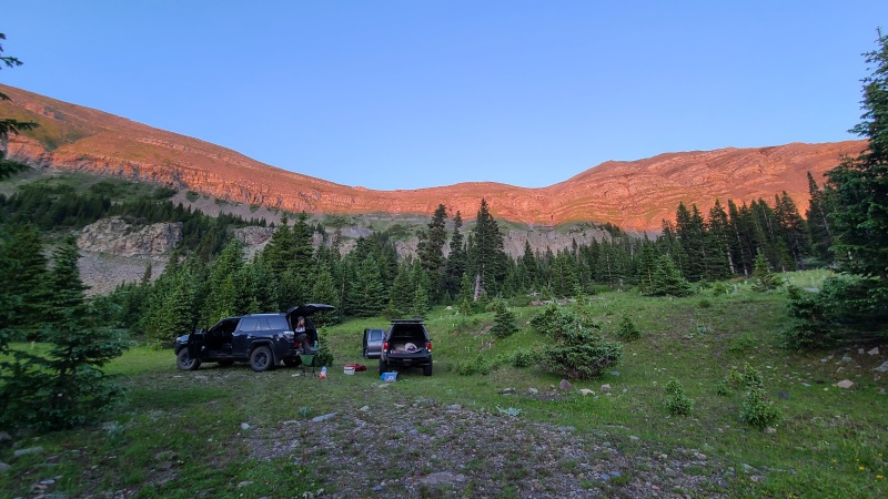
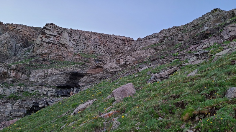
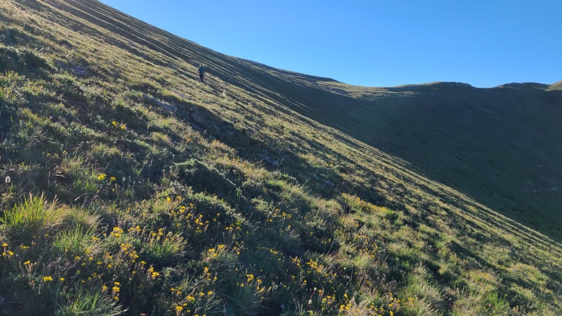
After arriving at camp we confirmed that both of our vehicles would be moved over to Carneros Creek drainage the following day, and Enrique and Javier left. Alex and Heather set up their beds in the backs of their vehicles and I set up my tent. Whiskey Pass is beautiful and we had it all to ourselves. We drank some beer, planned our route up the pass, which was a mix of steep, grassy benches, cliffs, and talus gullies, and went to bed early. We planned for a 5:30am start.
Heather being Heather and giving the one finger salute.Line we chose up Whiskey Pass.Point 12,810, which wasn't that appealing to hit first.Whiskey Pass at sunset. My tent was off in the trees.
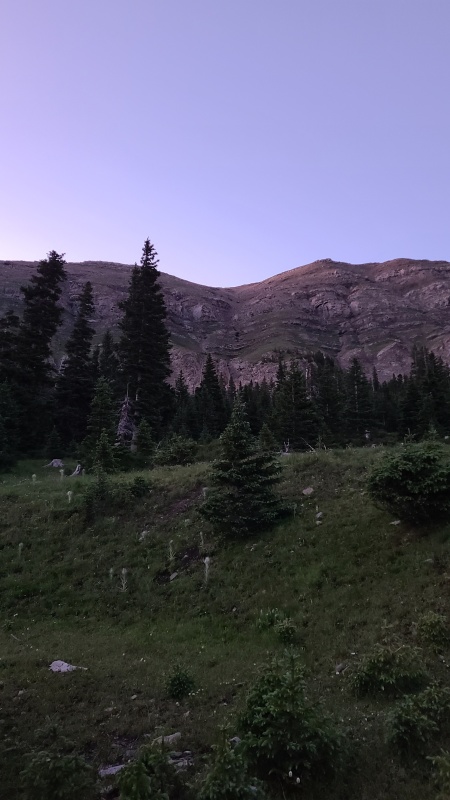
We were up at 4:30 the next morning, packed everything and left the cars unlocked and keys on the front seats so they could be shuttled over to Carneros. A few minutes before our planned start time we were off in the twilight.
Whiskey Pass in the early morning.
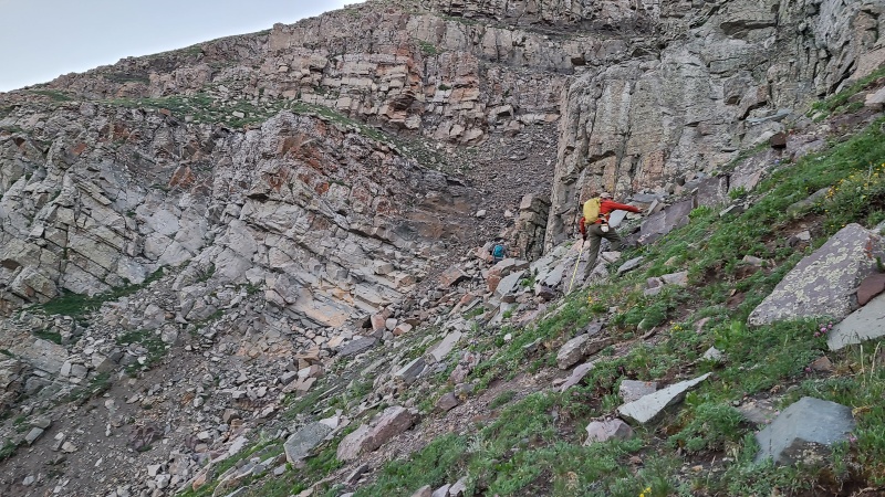
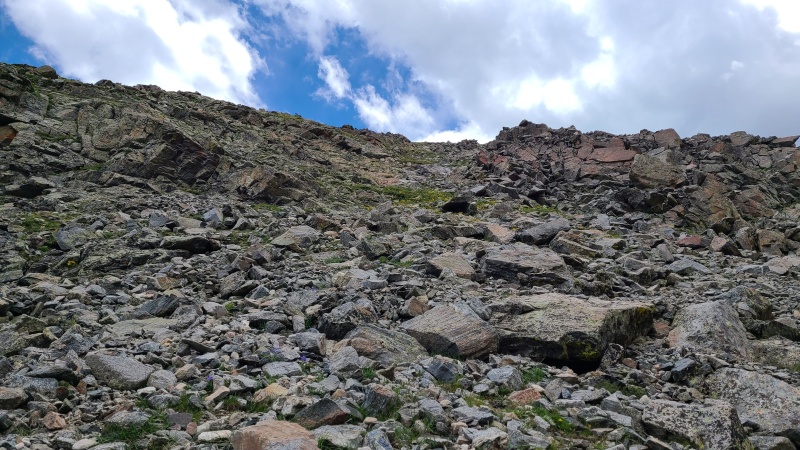
We were quickly out of the trees and began weaving through the numerous cliffs and gullies as we worked upwards. Though the terrain looked a little complex from below there was always a way to keep it easy.
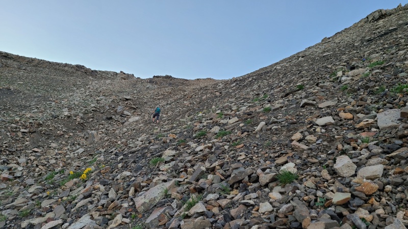
Looking south among the innumerable cliffs.Typical terrain ascending the pass.Sunrise on 12,810.
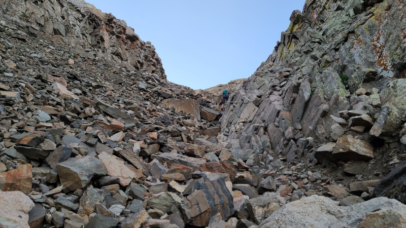
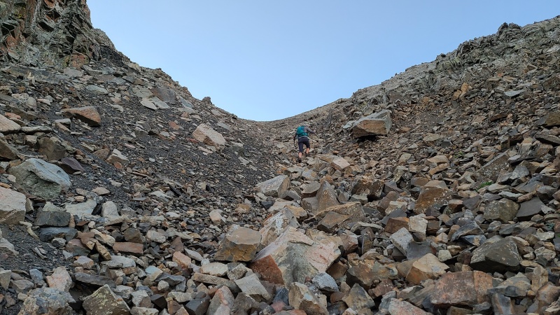
Our plan to find the central gully proved unnecessary. With a little route finding we were able to keep the ascent to Class 2+ and probably could have kept it to purely Class 2 if we wanted. None of the cliffs posed a problem as there were either easy breaks through them or they could just be bypassed entirely. Quicker than we expected we were above the complexities of the pass and onto steep talus and grass, which took us to the ridge.
Heather and Alex going around one of the many cliffs.A cruddy but easy talus gully Heather and I ascended to the upper slopes.Above the narrow part of the gully.Almost to the top.
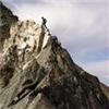
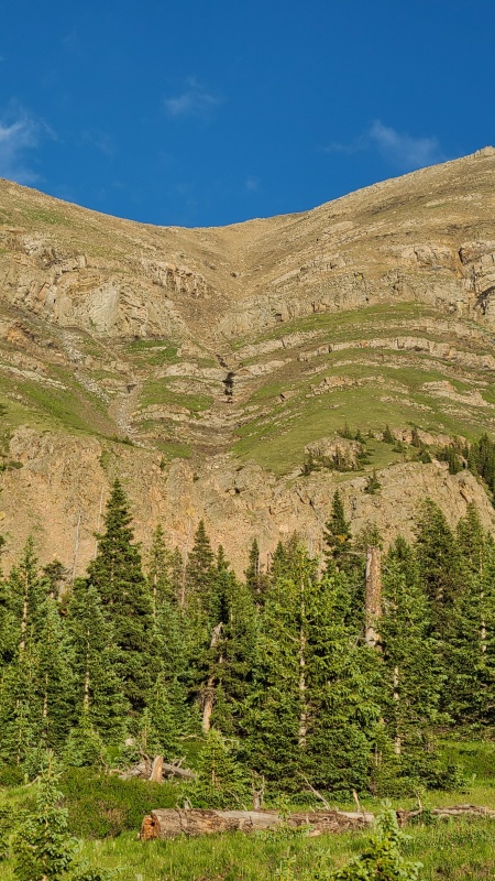
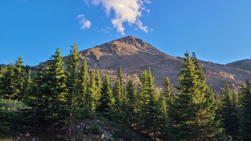
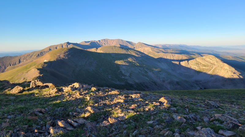
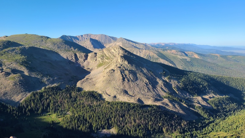
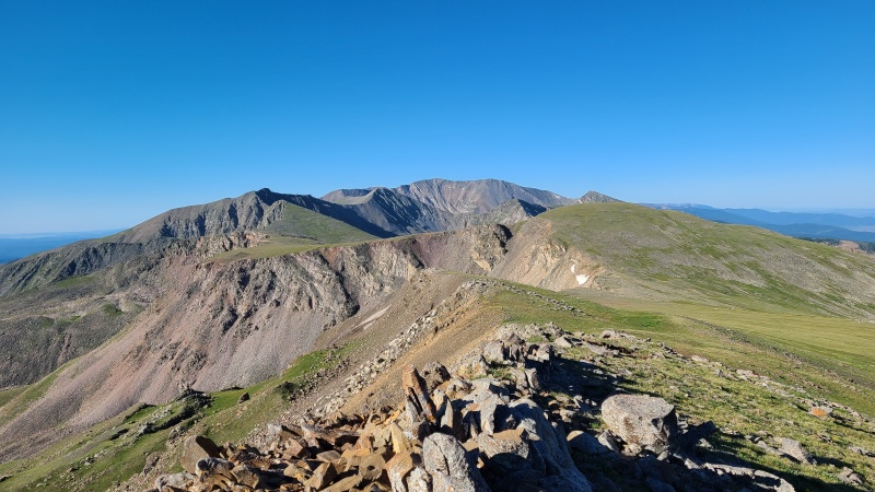
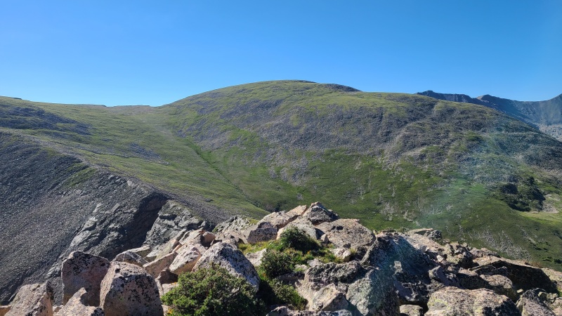
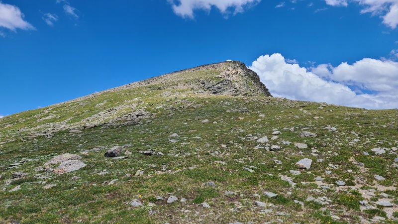
The first peak of the day, Beaubien Peak, was an easy grass romp once we reached the ridge. Heavenly views stretched in every direction.
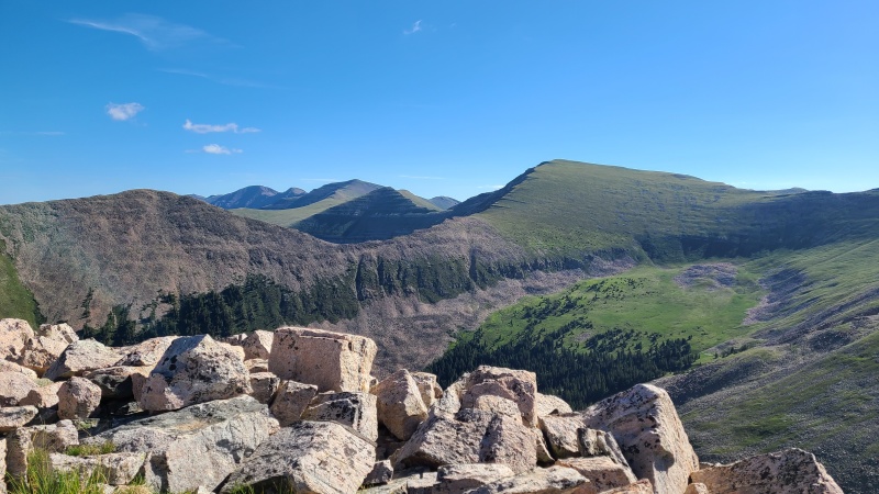
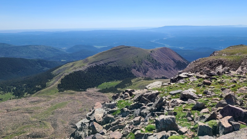
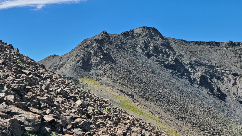
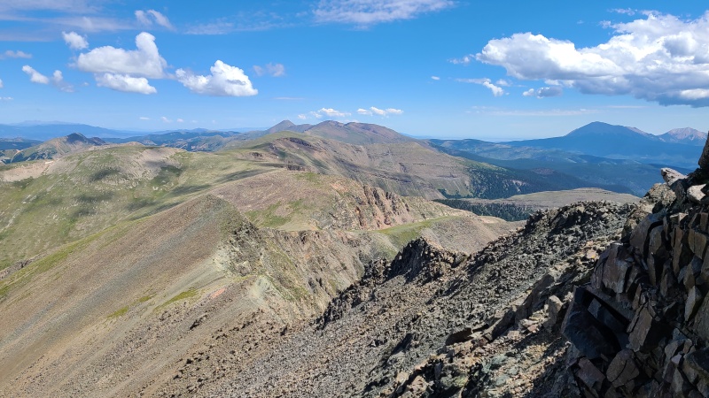
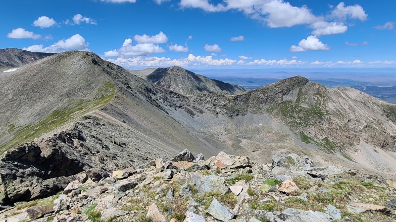
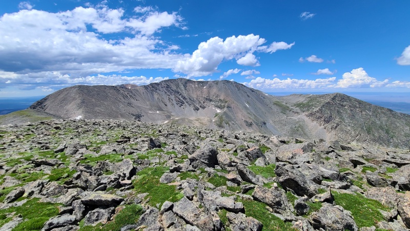
Looking north towards the pass itself, with the Blanca massif in the distance on the left and De Anza Peak B on the right.12,810 from Beaubien.South towards Culebra. Francisco Peak and Point 12,686 are in the foreground. We'd be going almost all the way to Culebra today.East towards the plains. Point 12,381 on the left is on Bar NI Ranch property so we didn't get to tag it.
At this early juncture in the day, after only a single peak, Heather and I departed from Alex. We wanted the twelvers west of the main ridge and were damn sure going to get them considering how much we paid for them. Alex didn't care about the twelvers and continued south towards Francisco Peak. Though 12,810 looked like a mess of talus from below it was actually quite easy - mostly moderate, stable rock with grass mixed in.
12,810 from Beaubien.Nearing the saddle.Ridge crest up 12,810.12,686 from 12,810. The ridge has some notches, which looked potentially troublesome from a distance.
We didn't stay long on the summit of 12,810, since the views weren't very good and we had tons still to go. Descending the ridge was fast, and when it made sense we began contouring on grass towards the Beaubien/Francisco saddle.
Heather en route to the Beaubien/Francisco saddle.All hail Great Lump Francisco. kazoo noises
Francisco was pretty meh, honestly, but it was part of our journey. We hiked up its grassy slopes to the summit at the top of a small cliff.
Small, hard to see cairn at the top of this point.Backside of Francisco.
Again we didn't stay long, and marched south before turning west towards 12,686.
12,686.More easy terrain going south. The large, grassy bump on the right is Lomo Liso Mountain.Forbidden fruit 12,381. Easy to get to, but outside the law.
As we got closer to 12,686 the notches we saw from 12,810, that looked like we might have to scramble down and up, didn't amount to anything. In fact, we couldn't even locate them at all now that we were closer.
12,686 and not a notch in sight.No notches. It must be magic.
A strange thing we discovered from the summit of 12,686 was a small cluster of fifth wheel campers high up in the middle of nowhere. They must belong to the ranch, but I don't know what their purpose would be. I also have no idea how they got up that high. The roads in the area are all pretty rough and I wouldn't want to drag a camper up any of them.
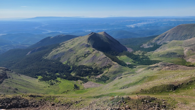
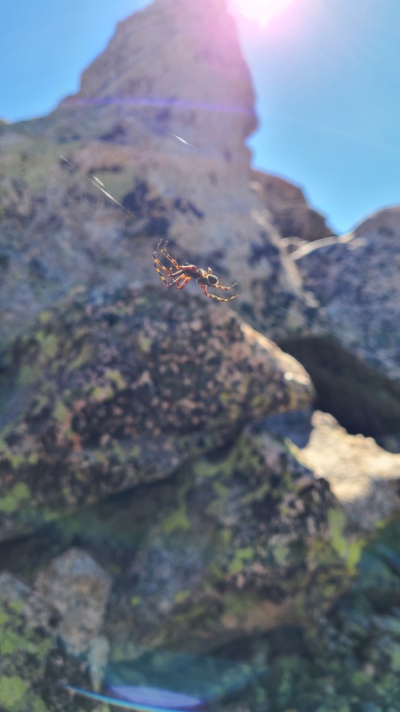
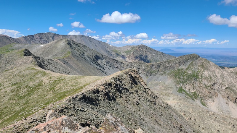
Four campers in an open area southwest of 12,686.Point 13,229 is the sharp, short peak directly across the drainage (Bernardino Creek). Culebra looms behind.Lame-o Liso Mountain. I mean Lomo Liso. Freudian slip, I swear.Looking back to Francisco's easy slopes.12,810 and Beaubien, with Whiskey Pass in center.Neat spider who set up home in the summit boulders.
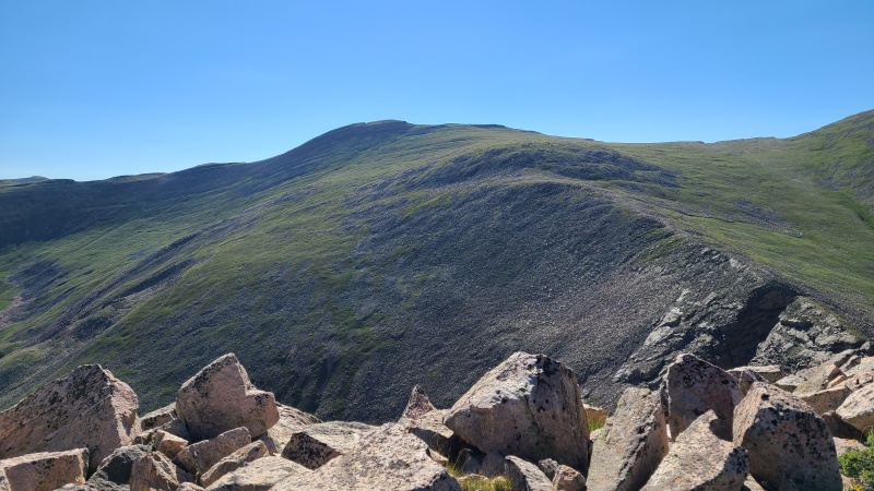
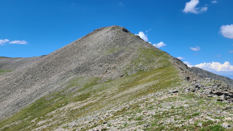
Lomo Liso was another big grass lump of unexcitement, and it came and went in short order.
Slopes up Lomo Liso, a gentle giant.
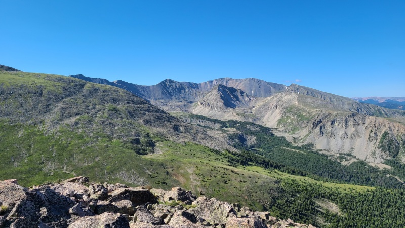
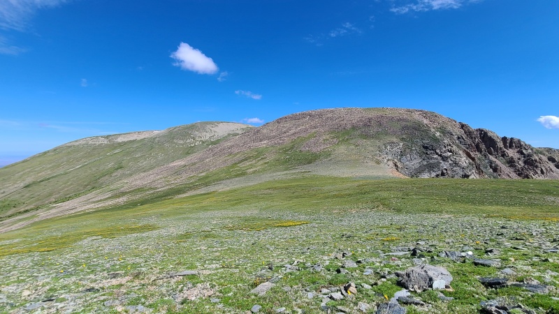
From Lomo Liso things finally started looking interesting again. We knew our next peak, Miranda Peak, would contain some scrambling, so we were excited for that after the first half of the day being somewhat lackluster.
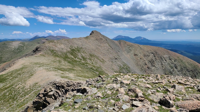
Miranda Peak in center with Point 13,565 and Point 13,229 on center right and right, respectively. The pointy grass slope hid the goods on Miranda.Francisco from Lomo Liso.Another shot of easy 12,381.
From Lomo Liso we dropped down on the last bit of grass for a while and began ascending to a sharp point, beyond which was unknown.
Descent off Lomo Liso.Start of cliffs on Miranda's east side.Bluer-than-blue Strawberry Lake.
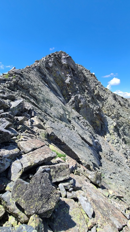
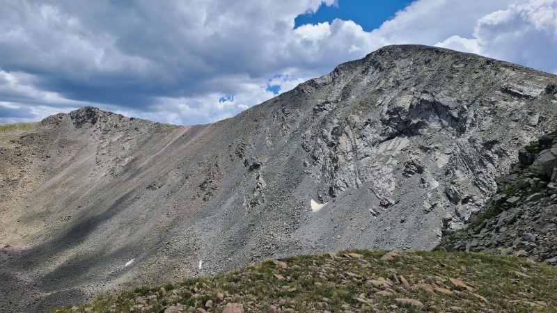
As we neared the sharp point it wasn't necessary to go all the way to the top. We skirted around it and were able to see that Miranda was made of mostly talus with some knife edge sections of scrambling.
Miranda looking miraculous.
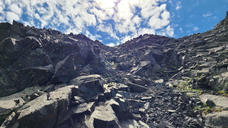
We crossed beneath an obvious gully and then spread out so we wouldn't knock rocks onto each other, since everything here was loose as a goose. Nothing particularly hard, no more than Class 2+, but a light touch was required.
Junky rock on Miranda. Rock quality improves on the ridge crest.
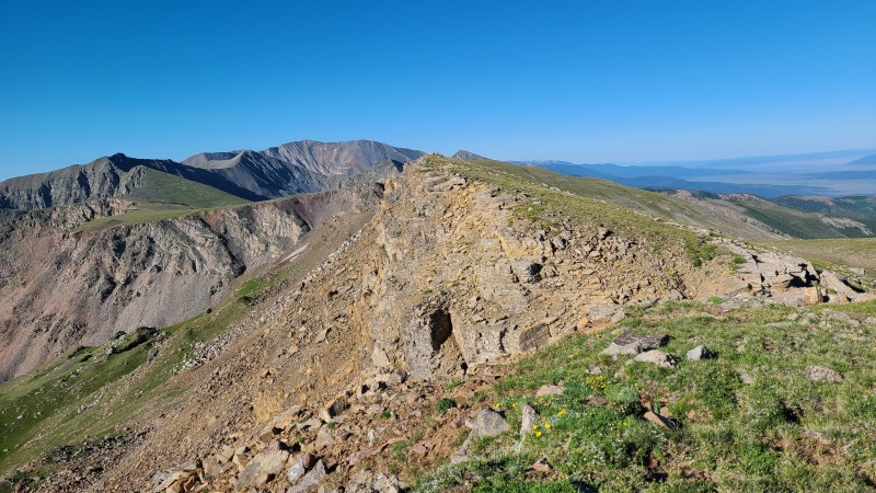
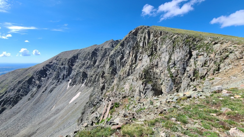
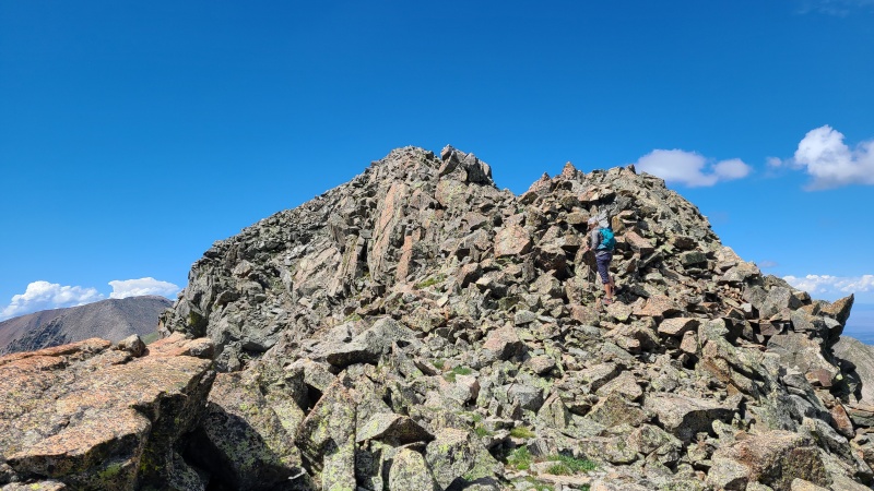
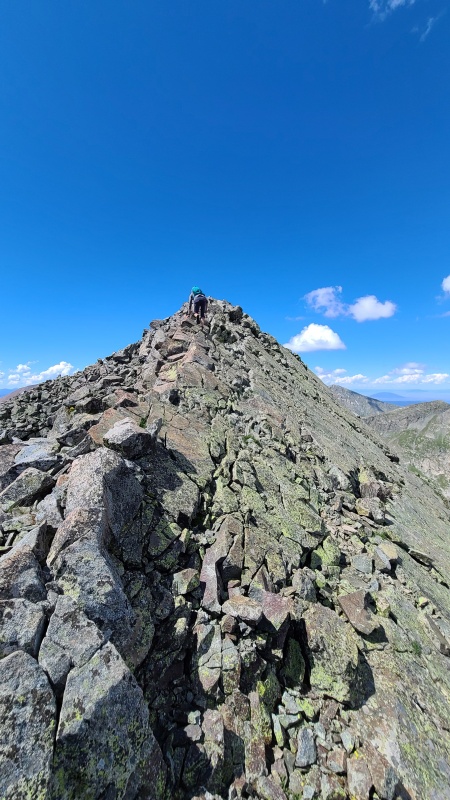
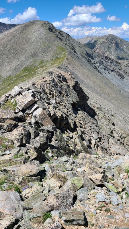
It took us a few minutes to scramble up to the ridge, where things markedly improved. Now it was all fun Class 2+ to Class 3 scrambling on great rock with a bit of exposure, yeehaw!
Better rock and a small amount of scrambling on an otherwise hiking-only day!Yummy. Again some loose rock but vastly better than the slopes below.
Miranda was the most interesting peak of the day, despite it being unranked. I've often found the unranked peaks to be more interesting than their ranked counterparts, and this was another to add to that list.
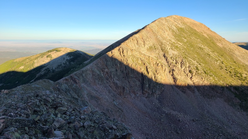
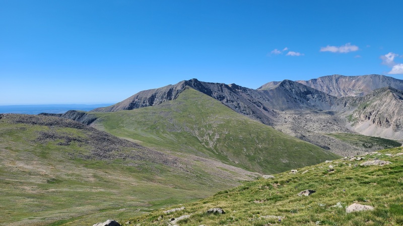
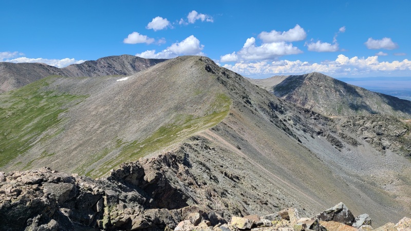
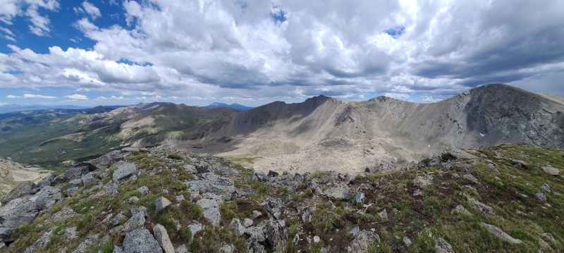
North towards most of the day's work. The Spanish Peaks are on the right.Last two peaks for the day, 13,565 and 13,229.
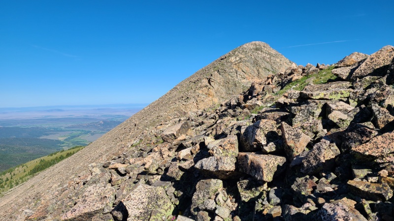
After Miranda's summit the difficulty again returned to Class 2. The fun was short but at least there was something to scramble on this otherwise easy day. Grass and broken rock took us down Miranda en route to our unnamed thirteener friends.
Miranda's unusual summit block.Easy terrain towards 13,565.Ridge between the two unnamed peaks.Broken crust.Another easy ascent up 13,565.Cool rock on the west side of the ridge near the summit.
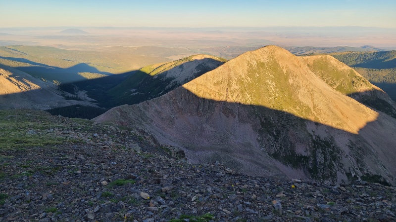
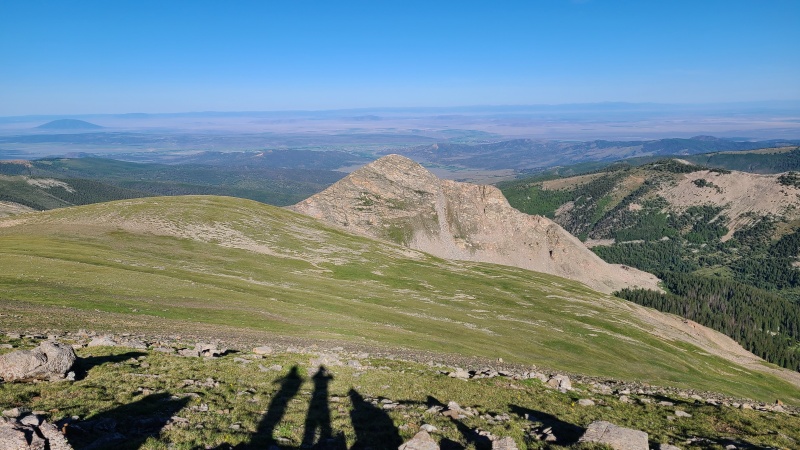
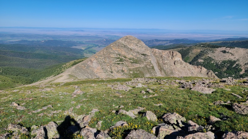
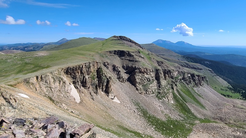
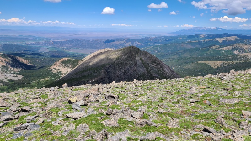
From the summit of 13,565 one gets a unique view of Culebra, one that isn't visible from the standard route up the latter. Culebra seems like a gentle giant but it's got its wild side too.
Culebra from 13,565.Diminutive 13,229.
We basked in Culebra's gaze for a few minutes and before long were off to our last peak of the day, 13,229.
Part of the ridge between Miranda and 13,565, which are left and right off frame, respectively.Miranda from the 13,565/13,229 saddle.
Another easy talus and grass peak, we dispatched it easily. Clouds were beginning to build and we were happy we'd soon be descending and staying there. Having to escape the ridge prior to completion probably wouldn't be difficult, but it would mean having to spend another $500 to come back and do whatever peaks we didn't get.
Up 13,229. Easy, breezy, 13,229girl.The long northern part of the Culebra Range with Miranda just right of center.
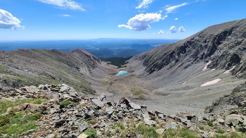
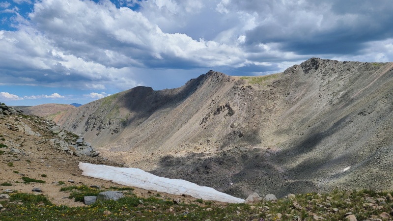
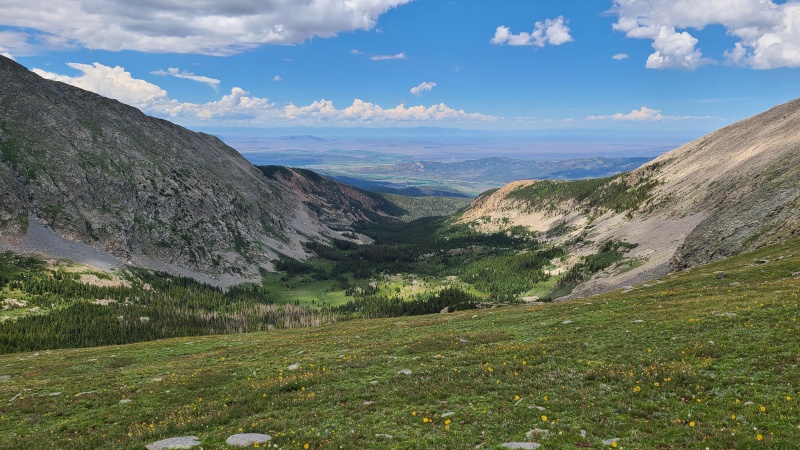
From 13,229 we knew we'd have to go south towards Culebra and drop through the cliffs guarding Carneros Lake, and we had no idea what this would be like. Off we set.
Descending south to seek a route to Carneros Lake.Carneros Creek drainage.
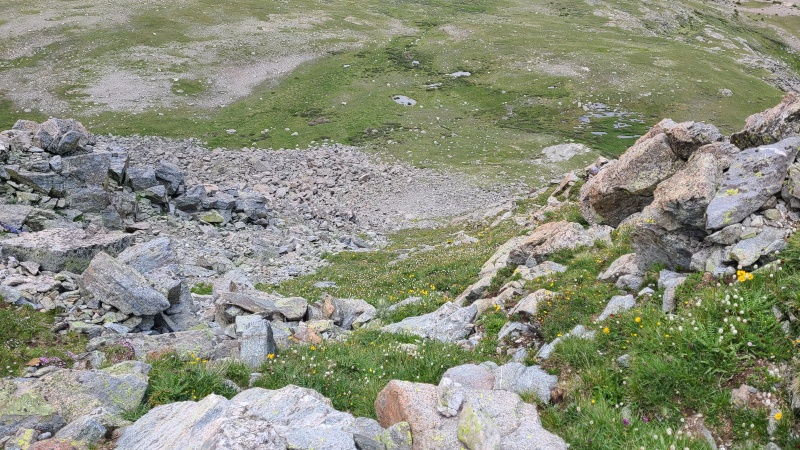
Easy grass led us to the top of the cliffs ringing the drainage. We didn't immediately find easy passage through the cliffs so we just walked along their tops, taking the first reasonable looking gully down, with maybe a move or two of Class 2+. The cliffs were easier than we were expecting them to be.
Gully into the drainage, mostly grass, all easy.The gully from the bottom. It looks worse than it is from this direction.
We were on easier ground now and weren't expecting any surprises, but we still had no idea what the walk out of the drainage would be like. Certainly there'd be route finding owing to the lack of trails or roads, but whether it'd be wet, bushwhacky, talus in the trees, whatever, we weren't sure. Route finding was easier than we expected as none of the potential slowdowns appeared. We'd mostly been worried about desert bushwhacking and deadfall, but the drainage was a cinch even in an unmaintained state.
Pretty little lake that no doubt sees few visitors.
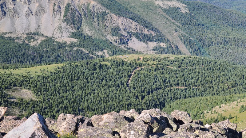
Down lower in the drainage we did encounter a trail, which started off weak and gained size and strength as we hiked. We weren't sure where the parking area was and hoped it would be obvious. If nothing else we figured we'd hit a road eventually and could find our way to the parking area from there, but the trail took us directly to the parking area. We were delighted to find that Heather's 4Runner was there, moved earlier in the day by the ranchers. We cheered and packed up our stuff before driving back to ranch headquarters, picking up my van along the way. If we were only doing these peaks we could have simply left but we got a second escort by the two brothers up to Purgatoire Peak's west ridge. We left my van at headquarters this time, since we'd be coming back this way again the following day - we asked Enrique and Javier if they'd move the 4Runner from Purgatoire to the Culebra 4WD trailhead so we could get another couple peaks, which they readily agreed to do.
The road to Purgatoire's west ridge is a lot steeper and rougher than the road to Whiskey Pass, but we didn't have any trouble following the brothers up. We set up camp in the trees there and went to bed early, since we'd have another big day to come, and afternoon storms were predicted. To read about the southern group, in all its glory, click here: Heavenly Views: Cielo Vista South Peaks, 2022 Update!
Statistics
Climbers: Ben Feinstein (myself), Heather R., Alex H. Trailhead: Whiskey Pass
Total distance: 14.67 miles Total elevation gain: 6,388 feet Total time: 8:56:42 Peaks: Four ranked thirteeners, two unranked thirteeners, two ranked twelvers
I was part of the group that did these peaks the weekend before you. Mike Offerman and I went up 12,810 before Beaubien, and we found it to be a fine and pleasant ascent, easy than it looks like going up Whiskey Pass from your photos.
Also worth noting that DeAnzaB is the northernmost end of CVR, and we were told by the ranch staff it was okay to bag during our trip. I didn't, but Randy and Tom did and it sounded like easy tundra walking.
Also, in your paragraph at the top where you say "The fee for the thirteeners is broken down into two groups:" you list Mariquita, which should probably say DeAnzaB since DeAnzaB is on CVR, while Mariquita is not.
I think the dot com is going down the drain when I see Lindsey poaching with millennial hieroglyphics until I read a Ben TR that is good and informative without the use of words like "bag" that is disrespectful or "subaruable" that is childish. Maybe I'm getting cranky since I've been here too long. Maybe it's better to burn out than fade away? Anyway, glad you're still burning bright you mountain tramp.
@Patrick: This is dated by a few years now, from before I even started doing the thirteeners if you can believe it, but when I asked Carlos which peaks CVR owns he stated that they own up to Trinchera, so including De Anza B and Mariquita. I too was under the impression that Trinchera-Blanca ranch owned the western side of the range in that area (Bar N-I for sure owns the eastern side), but I asked him about who owns what in the area.
Here's the reference image I sent to him:
And his email in return, stating that they own up to Trinchera.
I suppose it's possible that the ranch property changed when it was bought a few years ago, or that Carlos is actually wrong, but those both seem unlikely. For now I'm going to keep it as Mariquita is included, with a repeat warning that it is not legal to do them from Maxwell and that Bar N-I will charge hikers who come from that direction with trespassing.
@Amy: Nothing wrong with being cranky at what you're seeing, as I agree there's plenty of stupidity 'round these parts. But as always I'm trying to raise the bar from where it is way down in... wherever it is these days. ;) Plenty of burning to come, and plenty more TRs too!
Glad to see access continue on these peaks! We did them way back when Bobby Hill still owned the ranch!
I will second Patrick that if one did want to start on 12810, we went up the east facing grassy slopes in your image title "Sunrise on 12810" (photo 8) and found those to be pleasant. Saves a little bit of elevation and the talus gully you used to get to the pass.
I am not sure on the ownership either, it seems that CVR allows people to climb as far north as Mariquita but I am not sure they actually own the land that far north as I have heard conflicting things over the years. I didn't think they owned DeAnza B either, so I think there is some general confusion on the boundaries in that area that I am not sure how to resolve without digging into county assessors records.
It's pure speculation but I've often wondered if Cielo Vista has some kind of agreement with Trinchera-Blanca and/or Bar N-I to allow hiker access to peaks on the latter two's ranches (at least along the main ridgeline) from Cielo Vista property. Because Cielo Vista already has the infrastructure and logistics set up for hiker access to the peaks they are 100% known to own, it could be that they allow access to the peaks in what I'm going to call the "Culebra Triangle," which runs from Maxwell Peak south along the ridge to approximately De Anza or so. According to the Costilla county GIS website it appears that Cielo Vista doesn't even own De Anza B (marked with the blue dot) but they're pretty close...
Thanks for posting great beta on some seldom climbed peaks. Hopefully this keeps the boomers happy! Currently awaiting a return email for him to take my money on the S group
i have never had any interest at all in these peaks before reading this report. looks like a beautiful day to me! thanks for the writeup ben *kazoo noises*
I recall our group chatting with the ranch staff at the trailhead for a little while (Enrique was one of them I'm pretty sure) and we were told we could climb DeAnzaB but nothing further north of that. This is the first I've heard of them owning anything north of DeAnzaB, and to my knowledge, them allowing DeAnzaB to be climbed during a trip to CVR is a somewhat recent move.
I could be misremembering, Enrique could have been wrong in 2021, Carlos could have been wrong in 2019, or there's some agreement between ranches like you say. Might be worth following up on that 2019 email exchange for clarification while we're talking about it?
Caution: The information contained in this report may not be accurate and should not be the only resource used in preparation for your climb. Failure to have the necessary experience, physical conditioning, supplies or equipment can result in injury or death. 14ers.com and the author(s) of this report provide no warranties, either express or implied, that the information provided is accurate or reliable. By using the information provided, you agree to indemnify and hold harmless 14ers.com and the report author(s) with respect to any claims and demands against them, including any attorney fees and expenses. Please read the 14ers.com Safety and Disclaimer pages for more information.
Please respect private property: 14ers.com supports the rights of private landowners to determine how and by whom their land will be used. In Colorado, it is your responsibility to determine if land is private and to obtain the appropriate permission before entering the property.


")
")
")
")
")
")
")
")
")
")
")
")
")
")
")
")
")
")
")
")
")
")
")
")
")
")
")
")
")
")
")
")
")
")
")
")
")
")
")
")
")
")
")
")
")
")
")
")
")
")
")
")
")
")
")
")
")
")
")
")
")
")
")
")
")