| Report Type | Full |
| Peak(s) |
Purgatoire Peak - 13,679 feet Point 12,754 (LiDAR 12,761') "Alamosito" - 13,471 feet Vermejo Peak - 13,715 feet Red Mountain - 13,911 feet Culebra Peak - 14,053 feet |
| Date Posted | 03/27/2023 |
| Modified | 06/06/2024 |
| Date Climbed | 07/10/2022 |
| Author | supranihilest |
| Additional Members | hr011242 |
| Heavenly Views: Cielo Vista South Peaks, 2022 Update | ||||||||||||||||||||||||||||||||||||||||||||||
|---|---|---|---|---|---|---|---|---|---|---|---|---|---|---|---|---|---|---|---|---|---|---|---|---|---|---|---|---|---|---|---|---|---|---|---|---|---|---|---|---|---|---|---|---|---|---|
|
The Cielo Vista Ranch thirteeners comprise the vast majority of privately owned thirteeners in Colorado. Aside from Bartlett Mountain, site of the Climax molybdenum mine, Mariquita Peak and De Anza Peak B immediately to the north of Cielo Vista Ranch (hereby CVR), and Hamilton Peak in the Blanca massif, CVR owns all the remaining private thirteeners, plus of course 14er Culebra Peak. The group of thirteeners southh of Culebra, the subject of this trip report, is more sought after than those north of Culebra, as the southern group contains one Centennial thirteener and two Bicentennials. I wrote these trip reports for the CVR thirteeners in the interest of providing up-to-date information on accessing these peaks, since that information isn't really collected in a single, easy-to-find place.
Please note: this information was current as of July, 2022 and may be out of date by the time you read this report. It was updated in June, 2024 to state that De Anza Peak and Mariquita Peak are NOT part of CVR property and are NOT legally accessible from CVR property. For Culebra Peak and Red Mountain A:
For all of the other peaks, including thirteeners:
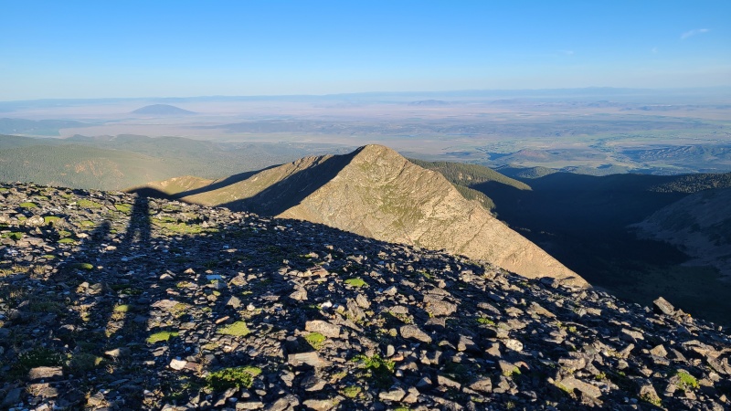
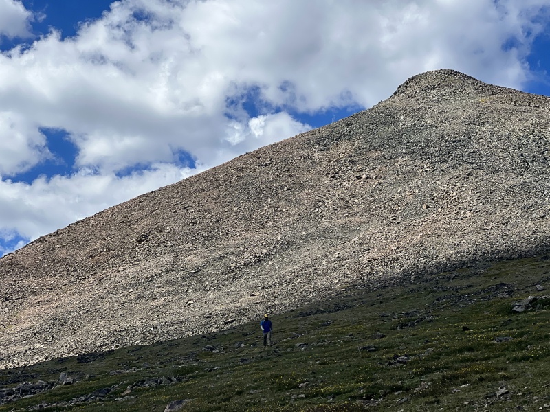
I wanted to personally thank the ranch staff, Carlos de Leon and his two sons, Enrique and Javier. They coordinated with us for two years (we had a vehicle breakdown the day before our climbs the first year and had to cancel last minute), answered tons of questions, bent the rules to allow us to climb two days in a row, drove all over the ranch for us, moved our vehicles for us both days, and were super friendly throughout it all. If you get the pleasure of talking to these fine gentlemen on climbs of your own be sure to thank them. They work their asses off for us climbers. With all that laid out, it's time to get to... The ClimbThe day prior Heather and I had climbed the northern group of CVR peaks, from Beaubien Peak south through Point 13,565 and Point 13,229. We'd then been escorted up the network of 4WD roads on the ranch to a small saddle on Purgatoire Peak's west ridge, where we camped in preparation for finishing off the remaining private thirteeners we had left - Purgatoire Peak, "Alamosito", and Vermejo Peak. We'd both already done Bartlett Mountain, Mariquita Peak, and De Anza Peak B on our own separate trips and we were ready to have these ones done. We'd set camp up in the dark and wolfed down our dinners. The night went quickly and for the second day in a row we were up at 4:30am in anticipation of a 5:30am start. Heather's used to getting up early but I'm not a big fan, unless of course peaks are the reason! We once again left her 4Runner unlocked with the car keys on the front seat, since the ranchers were going to move it over to the Culebra 4WD trailhead for us - thanks guys! We were afoot at about 5:20 - go us! - ascending through the trees. Twilight slowed us down but each passing minute meant more light, and we found ourselves above treeline in about 20 minutes. Grass led us into the sky. A glowing sunset welcomed us. 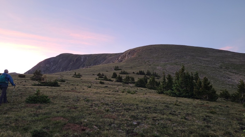
We continued up Purgatoire's obliging west ridge towards a point that blocked views of the summit. The mix of grass and random rock typical of the area was the same here. 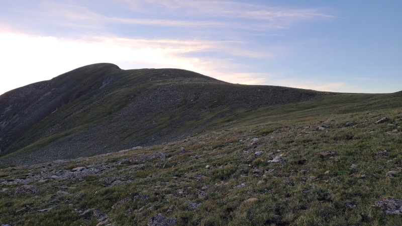

The bump had a few small cliffs on its south side that prevented us from easily bypassing it, but it wasn't that much extra to just go over it, so that's what we did. 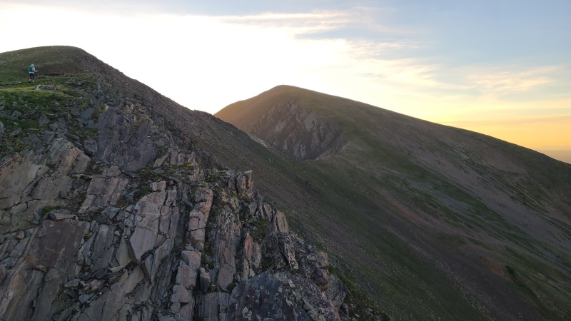
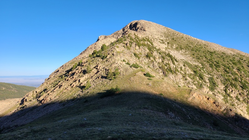
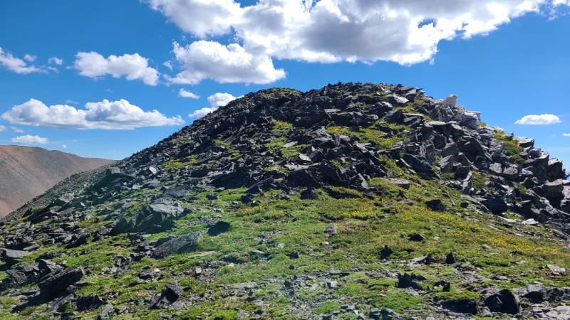
We rode the bump and headed towards Purgatoire's even larger lumpy bump, encountering an odd patch of white rock that seemed totally out of place on the ridge. 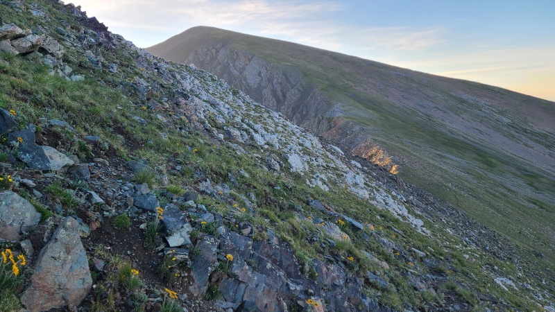
More of the same easy grass took us to the summit of Purgatoire, our first peak for the day. 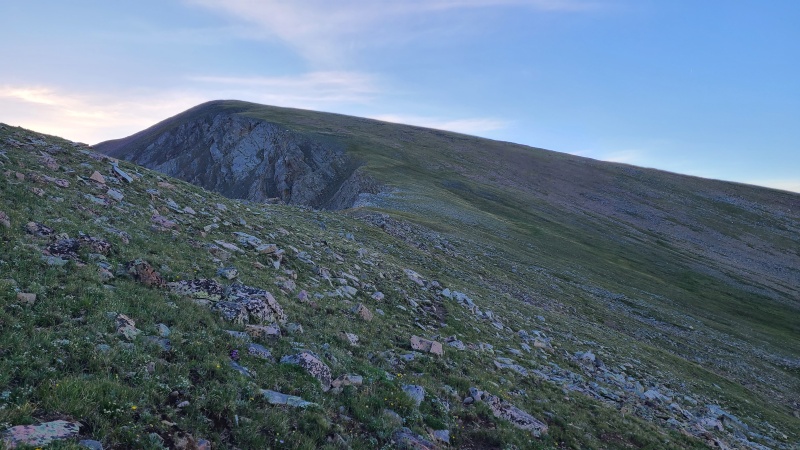
We wasted no time in scooting along the ridge. We were supposed to get storms around noon. Waste time? Nah. We dropped north towards "Alamosito". 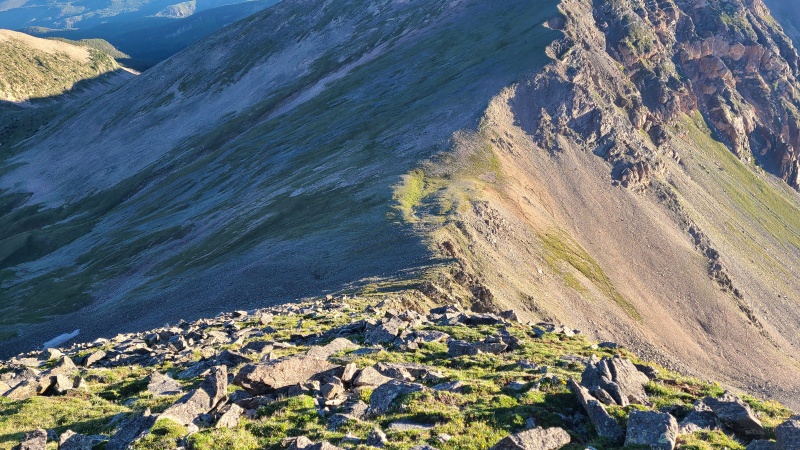
At the saddle we debated whether we should go for 12,754. Heather didn't think we had enough time with the predicted weather. I wanted to go for it because there was no way I'd pay again just to do a single twelver. After a bit of a back and forth we decided to go for it and that turned out to be a great idea - 12,754 was the best peak of the weekend by far! From the saddle we contoured along "Alamosito"'s southwest side on loose junk towards its saddle with 12,754. 
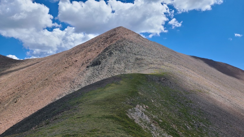
From this new saddle we got better views of our little twelver. It looked a lot more interesting from this angle, a lot less flat and boring than it appeared from the south. 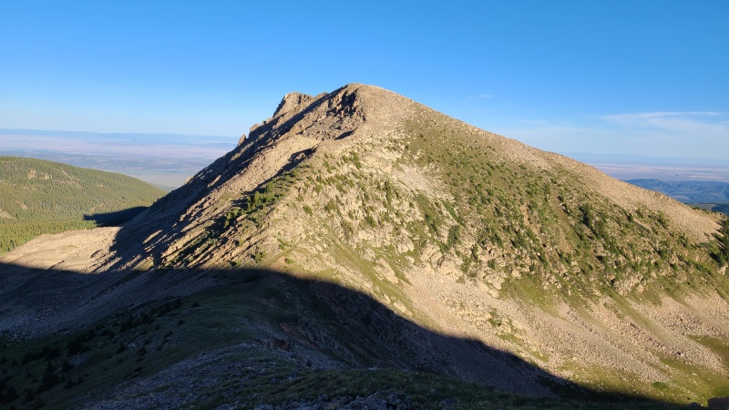
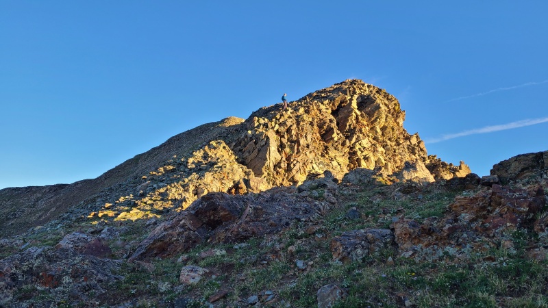
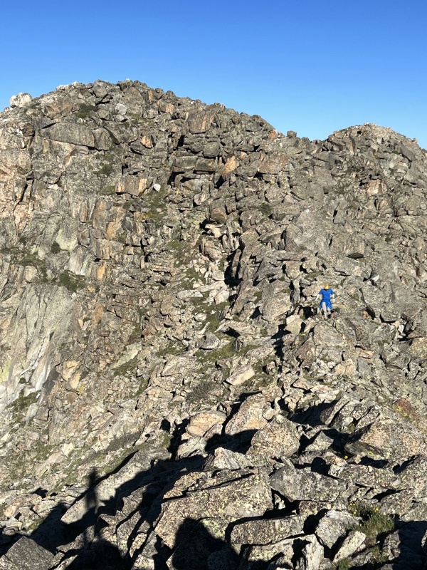
We dropped our packs at the saddle to move a little faster, hiked up the initial easy ridge, then found a rather out of place knife edge slab plopped into the middle of an otherwise grassy slope. 

The knife edge was short lived and we made sure to milk it, despite it being avoidable. From the end of the knife there was a slope of stable talus which led to the surprisingly narrow summit ridge. This peak was turning out great! 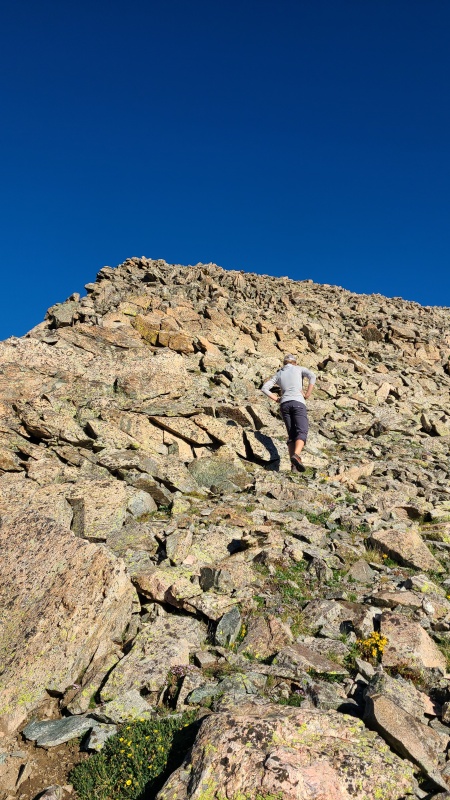
There was a little bit of Class 2+ scrambling to gain the sub-summit, descend it, and ascend to the true summit. 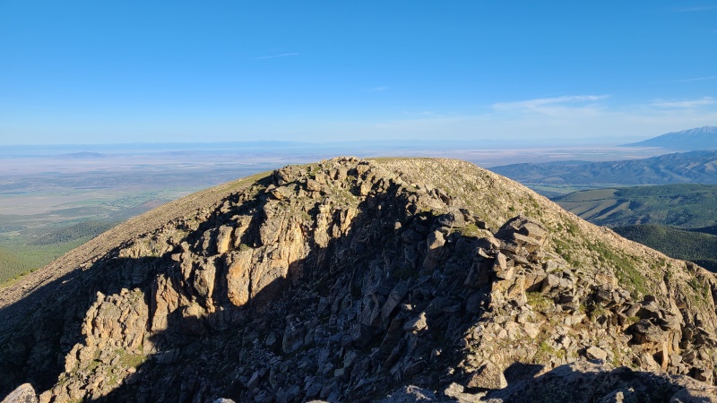

To add to the enjoyment of this peak, the summit register went back over 30 years and was signed by some of Colorado's greatest peakbaggers. 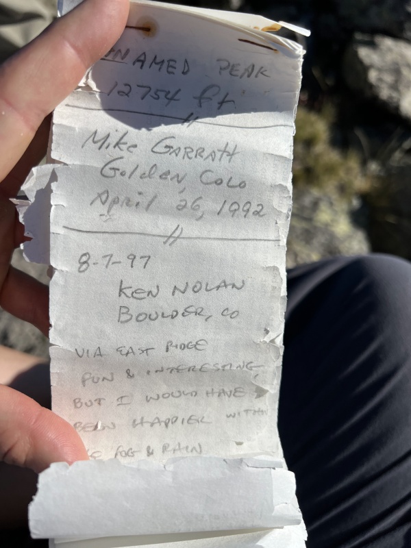
Only a moment's recharge time was required on 12,754 so we could soak in the fun scramble up. We were still concerned with weather, but we were glad we'd done this peak. Anyone doing this group of peaks in the future - I know you're after the thirteeners but this little twelver is far and away the most fun out of all of them. In fact we were about to find out just how meh the remaining peaks were. Down we went. 


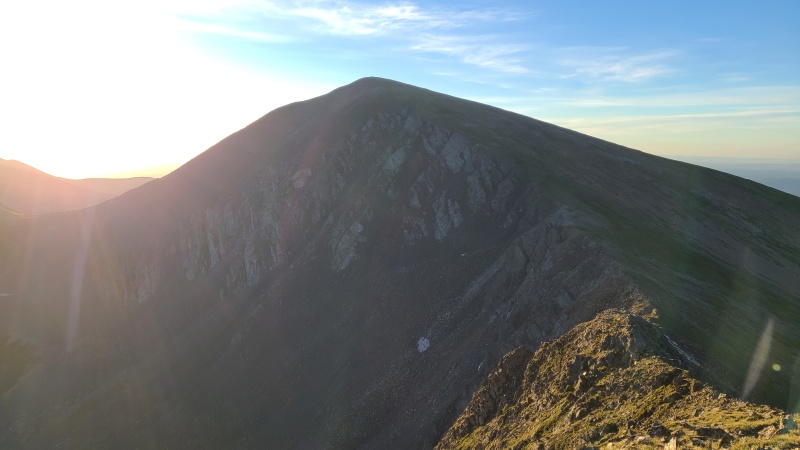
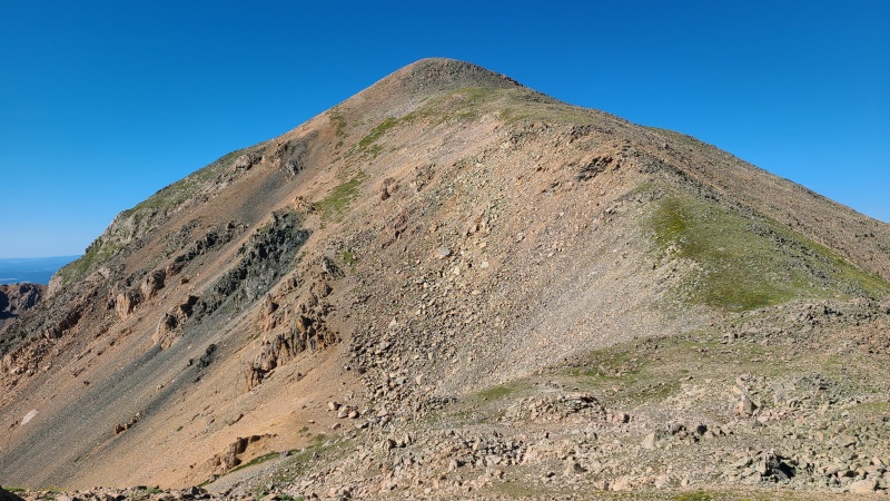
We hadn't really paid much attention to "Alamosito" in our rush to get up 12,754, but now it was staring us down. Or maybe we were staring it down. Mountains can't stare, after all. "Alamosito" was a behemoth of a peak, and steep, but it didn't contain anything noteworthy. Just a grind. 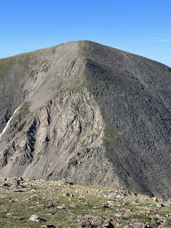
We huffed and puffed our way up "Alamosito"'s west ridge, still racing the clock. Bluebird skies reigned (not rained) but we were still sure something would show up, and with our vehicle being moved to another trailhead four peaks away we had to boogie. The grass and talus on "Alamosito" made for an easy climb and before long we were on top. Halfway done with the day. 

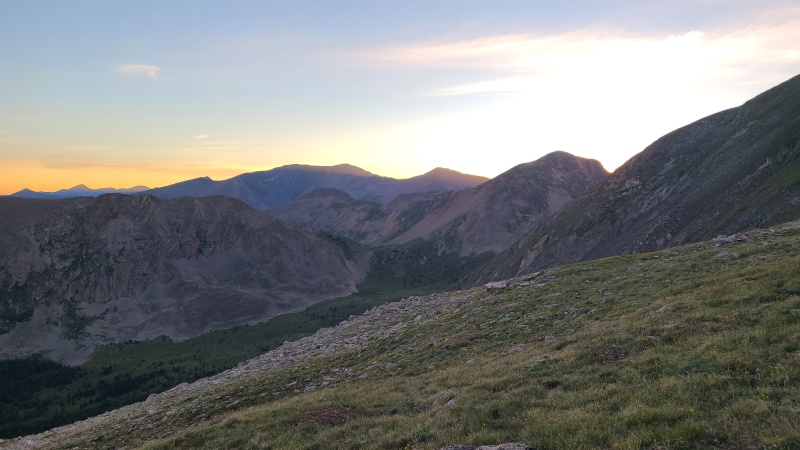
After another few minutes of rest on "Alamosito" we hiked down its moderate north ridge. The initial descent was on loose talus which gave way to more grass. The descent was quick, followed by a long, easy ridge romp typical of the Culebra range. 
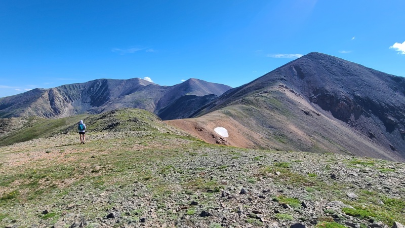
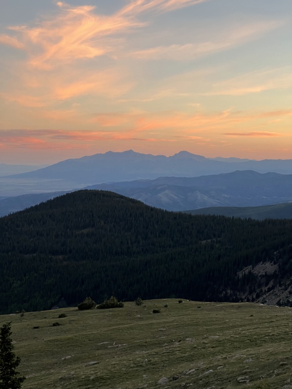
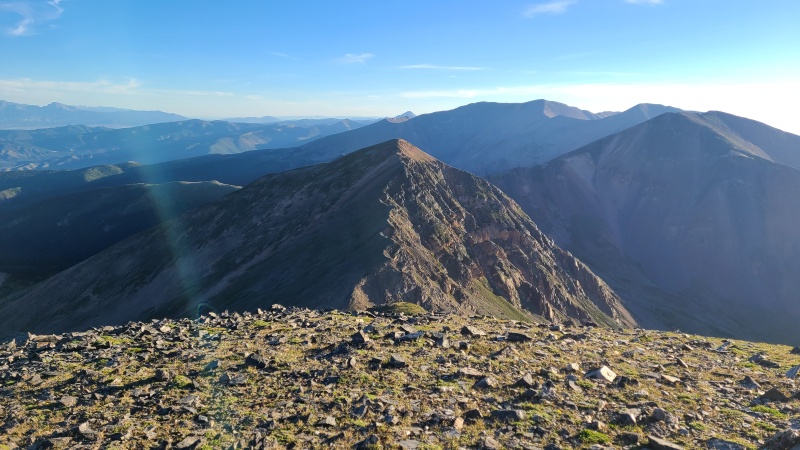
The solitude of the two days we spent on the ranch is not to be understated. Thirteeners don't often have other people on them - I think of the hundreds I've done I've encountered others on perhaps a dozen - but the solitude here is something else. It's not like we were going to encounter backpackers, leaf peepers, bird watchers, or anyone else up here (at least until we got to Red and beyond, which is optional anyway). Most of the time we didn't even speak, we just let the mountains do their magic. It might have been fun to do these peaks with a bigger group but spending time in the mountains with just a single friend can be sublime. No trails. No Jeeps. No Bluetooth speakers. No hordes. Solitude. Enjoy it when you can get it. The prime terrain of the ridge between "Alamosito" and Vermejo did, unfortunately, have to come to an end eventually. As Vermejo reared up the quality of rock deteriorated into loose, red scree and talus. While not as steep as "Alamosito", Vermejo was a bit annoying after a series of quality peaks. We pushed through up the rock to an easier (but no less loose) summit ridge, and then onto the surprisingly grassy summit. 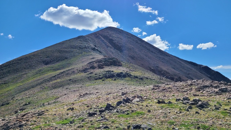
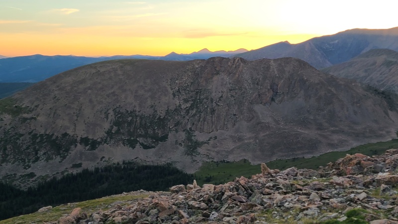
Well, that was the last of the new peaks for the weekend. Heather and I had both already done Culebra twice, once in summer, once in winter, and had of course already done Red on our summer climbs, but we figured it would make for a more interesting day adding them on at the end. Most people doing these peaks just get to Vermejo and loop back to their camp on Purgatoire. Not us! Why do fewer peaks when you can do more peaks? Rhetorical question, of course. Red from here looked pretty crappy. Spoiler alert: it was. But first we had to make our way down Vermejo, which was also pretty crappy. Oh how I love red, rotten rock. It's my favorite. 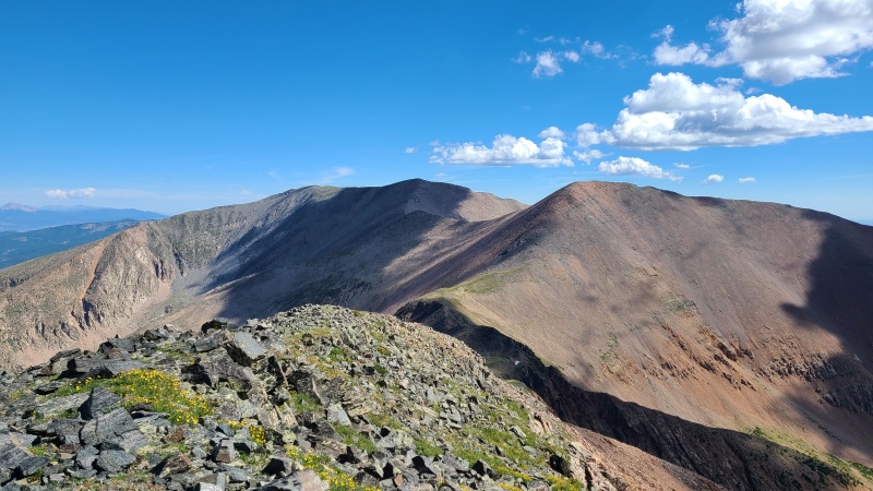
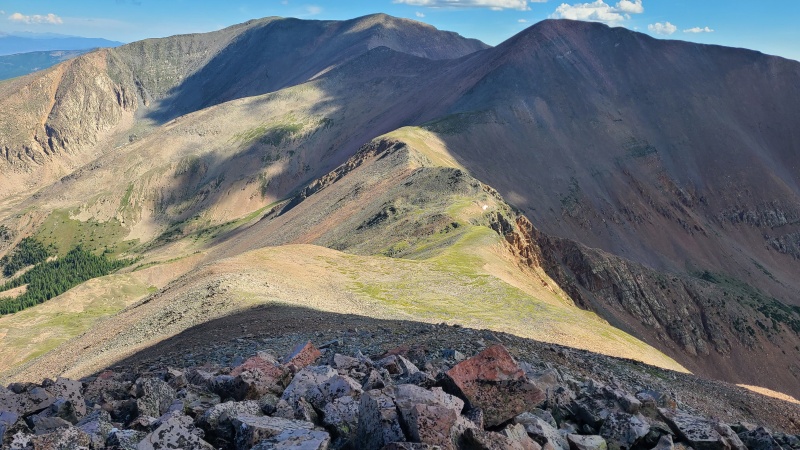
Really, the descent off Vermejo to the north was just a preview of how cruddy Red would be, since it was pretty junky but still easier than Red. 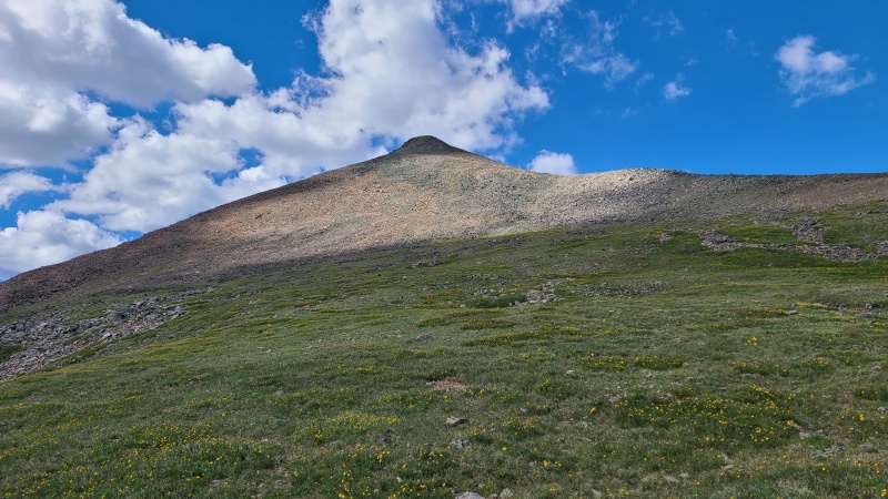
There was another easy grass romp between Vermejo and Red, where we encountered our second and final spot of white rock plopped randomly in the middle of nowhere. 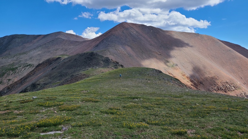

As we reached the bottom of the actual red on Red, we steeled ourselves for the junk to come. There was something like 700 vertical feet to the summit, and it was steep, loose, angular, and probably some more unpleasant adjectives. Heather took off her long-sleeved shirt to get ready. We spread apart from each other so we wouldn't be kicking rocks onto each other's heads and began the Class 2+ ascent. 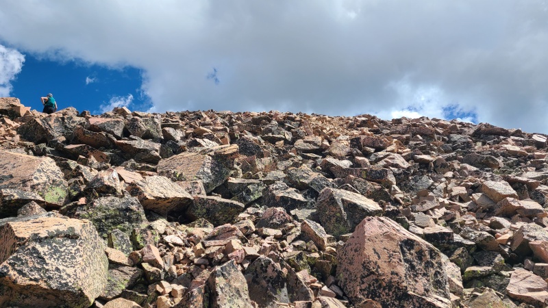
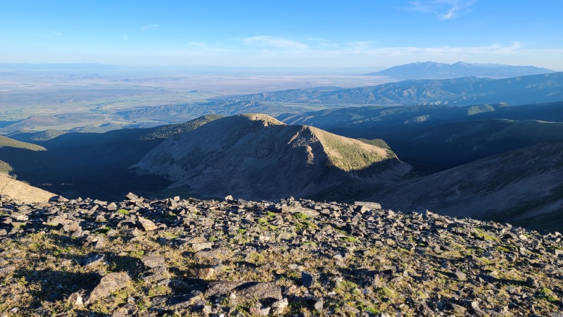
Red from here was a slog. It's not the nicest peak from Culebra but it's got a trail and is pretty moderately angled. This side of the peak not so much. We cursed our way up. Then there were people on the summit. Welcome to reality. 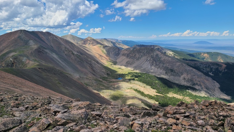
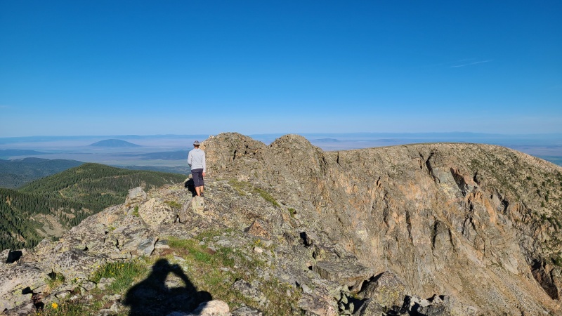
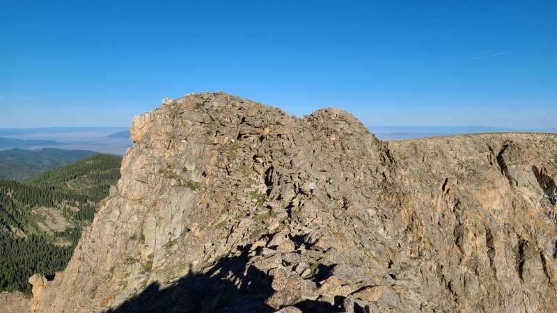
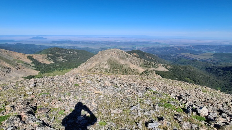
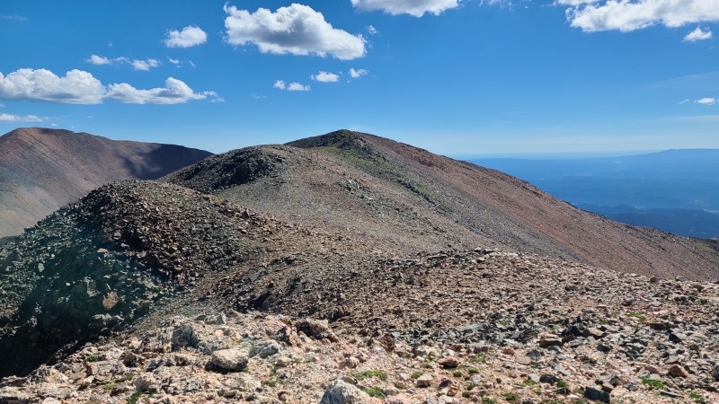
Since we were now among the living we spent no more time on the summit than it took to take a couple of photos. We jetted towards Culebra to get away from the other people up here. They seemed surprised to see us come up the way we had. We quickly left them behind and reached Culebra after about half an hour, our quickest time between peaks. The distance and gain was a lot less than any of the others, and the terrain hospitable, with a trail between the two. From Culebra's summit we had expansive views in all directions. The peak does have nearly 5,000 feet of prominence, after all. 
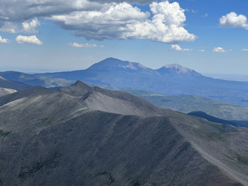
It was about noon by the time we reached Culebra and we found it empty, so we took a good break here. It's not often you see someone on a thirteener, and it's also not often you have a fourteener to yourself. As people began approaching from both directions we took off so we could enjoy as much alone time as we could. I'd forgotten how Pointy Culebra's summit was, having only remembered how gentle the ascent was on the standard route. Culebra's got some nice white granite on it too, a change from the red rock to the south. 
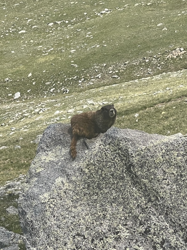
As we made our way off the summit ridge we meandered through the grassy meadows below the peak. Along the way we encountered a fat marmot named Steve (they're all named Steve) who did its best to be fat and hide from us. 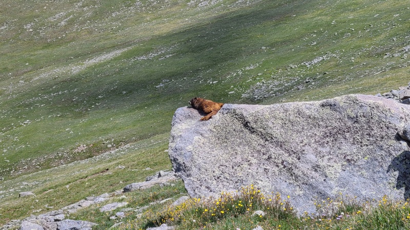

We frolicked through the grass and wildflowers on the upper slopes and made our way to the 4WD trailhead with ease. There was a Subaru up that high, and lo and behold Heather's 4Runner parked off in a corner! Many thanks to the ranchers for shuttling her vehicle for us. We rather enjoyed doing the unusual and adding Red and Culebra to this day. We drove back to ranch headquarters and checked out, saying thanks and goodbye to Enrique and Javier, who told us Carlos would wait for us at the gate to let us out. I got in my van and we headed to the gate where we talked with Carlos for five or ten minutes. I showed him my Sprinter camper van before he opened the gate and bid us farewell. These two days on the Cielo Vista Ranch had been amazing and Heather and I were both super stoked to have all of the private thirteeners done with. Is paying what we paid expensive? Sure. But it almost guarantees you'll have all of these peaks entirely to yourselves, and they are utterly pristine, something that can't be said for the vast majority of other thirteeners. It's the fees and access issues themselves that keep these peaks so pristine, and in a way we are grateful that they're so well protected. The ranchers were very friendly and helpful as well, and added a lot of value to what we had to pay. Of course, I'd rather be able to do these free whenever I wanted, but that's just not how the world is. Maybe in another universe. That said, we both agreed that these peaks were absolutely worth it. It's not often one gets such spectacular mountains truly and wholly to themselves. We took that to heart and we hope you do too. Thanks for reading. StatisticsClimbers: Ben Feinstein (myself), Heather R. Total distance: 11.64 miles
Splits:
Version history:
Thumbnails for uploaded photos (click to open slideshow): ")
")
")
")
")
")
")
")
")
")
")
")
")
")
")
")
")
")
")
")
")
")
")
")
")
")
")
")
")
")
")
")
")
")
")
")
")
")
")
")
")
")
")
")
")
")
")
")
")
")
")
")
")
")
")
|
| Comments or Questions | |||
|---|---|---|---|
|
Caution: The information contained in this report may not be accurate and should not be the only resource used in preparation for your climb. Failure to have the necessary experience, physical conditioning, supplies or equipment can result in injury or death. 14ers.com and the author(s) of this report provide no warranties, either express or implied, that the information provided is accurate or reliable. By using the information provided, you agree to indemnify and hold harmless 14ers.com and the report author(s) with respect to any claims and demands against them, including any attorney fees and expenses. Please read the 14ers.com Safety and Disclaimer pages for more information.
Please respect private property: 14ers.com supports the rights of private landowners to determine how and by whom their land will be used. In Colorado, it is your responsibility to determine if land is private and to obtain the appropriate permission before entering the property.


